Waterway information

Kind:
Inland
Driving areas:
🌊 Atlantic Ocean🇺🇸 United States of America
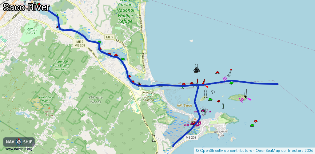
Length:
16.1 km¹
¹River kilometers or bank length recorded in NavShip, including river arms and harbor entrances.
Availability:
Completely recorded
Recent Update: 17.10.2025²
² This date indicates when an adjustment last took place in the course of the body of water
Recorded:
Locks: 0
Harbours / marinas: 1
Bridges: 0
Berths: 2
Slipways: 0
Fuelstations: 0
Route:
Please wait, loading route graphic...
Request waterway overview map with symbol legend here (Link).
Information about data associated with this body of water (3 available):
Data by OpenSeaMap (c) OSM contributors, www.openseamap.org
| # | Kind | Coordinates | Name | Information |
|---|---|---|---|---|
| 1 | Marina | 43.44633,-70.3556 | 2025-09-07T19:05:12Z | Biddeford Pool Yacht Club https://www.biddefordpoolyachtclub.org/ |
| 2 | Berth | 43.44542,-70.35866 | 2025-09-07T16:21:52Z | small_craft_mooring |
| 3 | Berth | 43.45032,-70.35373 | 2025-09-07T19:05:12Z | small_craft_mooring |