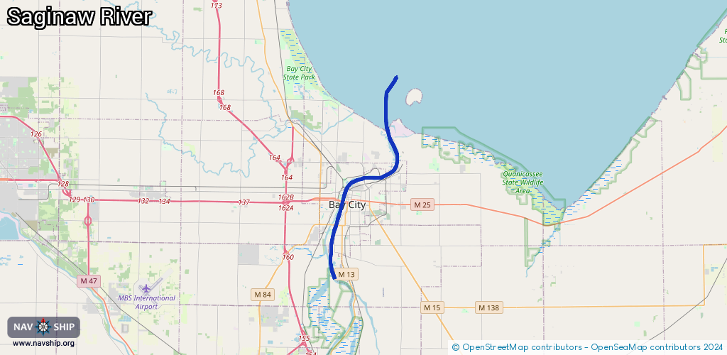
Waterway information

Kind:
Inland
Driving areas:
🇺🇸 United States of America
Length:
19.1 km¹
¹River kilometers or bank length recorded in NavShip, including river arms and harbor entrances.
Availability:
Completely recorded
Recent Update: 28.11.2023²
² This date indicates when an adjustment last took place in the course of the body of water
Recorded:
Locks: 0
Harbours / marinas: 5
Bridges: 0
Berths: 0
Slipways: 3
Fuelstations: 1
Route:
Please wait, loading route graphic...
Request waterway overview map with symbol legend here (Link).
Information about data associated with this body of water (9 available):
Data by OpenSeaMap (c) OSM contributors, www.openseamap.org
| # | Kind | Coordinates | Name | Information |
|---|---|---|---|---|
| 1 | Marina | 43.62797,-83.83786 | 2024-11-15T12:19:24Z | Coast Guard Basin |
| 2 | Marina | 43.62514,-83.8373 | 2024-11-15T13:32:13Z | Saginaw Bay Yacht Club https://sbycmi.com/ |
| 3 | Marina | 43.60947,-83.88843 | 2024-07-21T04:25:01Z | |
| 4 | Marina | 43.60199,-83.89347 | 2024-02-15T21:08:28Z | Pier 7 Marina +1 989 894 9061 https://www.pier7marina.com/ |
| 5 | Marina | 43.60063,-83.89452 | 2024-07-21T03:50:56Z | Liberty Harbor Marina |
| 6 | Slipway | 43.62821,-83.83763 | small_craft_facility | 2024-11-15T12:19:24Z |
| 7 | Slipway | 43.62454,-83.83702 | small_craft_facility | 2024-11-15T13:12:34Z |
| 8 | Slipway | 43.62596,-83.83911 | small_craft_facility | 2024-11-15T13:12:34Z |
| 9 | Fuel station | 43.60179,-83.89315 | 2024-02-15T21:08:28Z |