Waterway information

Kind:
Inland
Driving areas:
🇩🇪 Germany
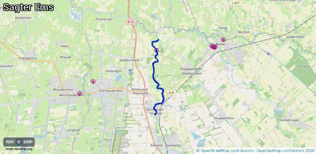
Length:
7.7 km¹
¹River kilometers or bank length recorded in NavShip, including river arms and harbor entrances.
Availability:
Completely recorded
Recent Update: 05.02.2019²
² This date indicates when an adjustment last took place in the course of the body of water
Recorded:
Locks: 0
Harbours / marinas: 1
Bridges: 2
Berths: 0
Slipways: 0
Fuelstations: 0
Route:
Please wait, loading route graphic...
Request waterway overview map with symbol legend here (Link).
Information about data associated with this body of water (3 available):
Data by OpenSeaMap (c) OSM contributors, www.openseamap.org
| # | Kind | Coordinates | Name | Information |
|---|---|---|---|---|
| 1 | Marina | 53.16578,7.67195 | 2023-05-11T09:19:43Z | Bootsanleger Wassersportverein Elisabethfehn e.V. +49 4499 921250 http://wsv-elisabethfehn.de/ |
| 2 | Bridge | 53.13591,7.6788 | Unknown | Clearance height: 2014-05-03T17:33:33Z m Maximum passage width: 4 m fixed |
| 3 | Bridge | 53.16494,7.67235 | Unknown | Clearance height: 2025-11-17T09:43:40Z m Movable bridge (e.g. lifting bridge or drawbridge) opening |