Waterway information

Kind:
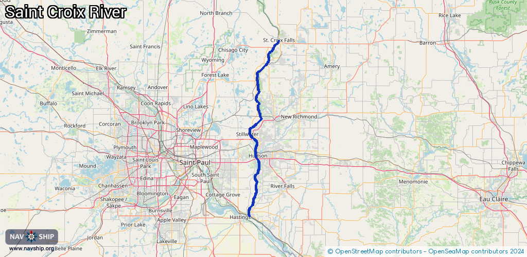
Inland
Driving areas:
🇺🇸 United States of America
Length:
86 km¹
¹River kilometers or bank length recorded in NavShip, including river arms and harbor entrances.
Availability:
Completely recorded
Recent Update: 24.11.2023²
² This date indicates when an adjustment last took place in the course of the body of water
Recorded:
Locks: 0
Harbours / marinas: 13
Bridges: 0
Berths: 0
Slipways: 1
Fuelstations: 0
Route:
Please wait, loading route graphic...
Request waterway overview map with symbol legend here (Link).
Information about data associated with this body of water (14 available):
Data by OpenSeaMap (c) OSM contributors, www.openseamap.org
| # | Kind | Coordinates | Name | Information |
|---|---|---|---|---|
| 1 | Marina | 45.41931,-92.64847 | 2021-01-21T04:35:57Z | |
| 2 | Marina | 45.20286,-92.76577 | 2023-03-31T01:43:46Z | |
| 3 | Marina | 45.0811,-92.79301 | 2023-01-08T16:28:54Z | Boomsite Marina |
| 4 | Marina | 45.07624,-92.80492 | 2023-01-08T16:50:49Z | Wolf Marina |
| 5 | Marina | 45.0745,-92.80454 | 2023-01-08T16:50:49Z | Ole Sawmill Marina |
| 6 | Marina | 45.06178,-92.80542 | 2022-04-08T00:15:38Z | Stillwater Marina |
| 7 | Marina | 45.04204,-92.79273 | 2023-01-17T03:08:51Z | Port of Sunnyside Marina https://www.sunnysidemarina.com/ |
| 8 | Marina | 45.00587,-92.77796 | 2023-01-08T17:00:06Z | Bayport Marina |
| 9 | Marina | 44.96772,-92.7579 | 2022-04-02T05:02:20Z | St. Croix Marina |
| 10 | Marina | 44.96011,-92.76514 | 2022-01-03T20:57:34Z | Beanie's Marina |
| 11 | Marina | 44.90072,-92.7797 | 2025-08-31T08:39:07Z | Windmill Marina |
| 12 | Marina | 44.74842,-92.80328 | 2023-01-08T15:20:58Z | Prescott City Docks |
| 13 | Marina | 44.74697,-92.8019 | 2026-01-28T14:39:22Z | |
| 14 | Slipway | 45.06055,-92.80549 | Unknown | 2017-04-13T15:03:28Z |