Waterway information

Kind:
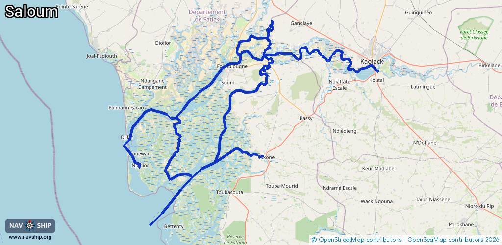
Inland
Driving areas:
🌊 Atlantic Ocean🇸🇳 Senegal
Length:
282.6 km¹
¹River kilometers or bank length recorded in NavShip, including river arms and harbor entrances.
Availability:
Completely recorded
Recent Update: 08.04.2025²
² This date indicates when an adjustment last took place in the course of the body of water
Recorded:
Locks: 0
Harbours / marinas: 7
Bridges: 0
Berths: 0
Slipways: 0
Fuelstations: 0
Route:
Please wait, loading route graphic...
Request waterway overview map with symbol legend here (Link).
Information about data associated with this body of water (7 available):
Data by OpenSeaMap (c) OSM contributors, www.openseamap.org
| # | Kind | Coordinates | Name | Information |
|---|---|---|---|---|
| 1 | Marina | 13.91792,-16.6093 | 2024-01-03T11:39:32Z | Bassar |
| 2 | Marina | 14.18554,-16.26854 | 2024-01-25T14:59:00Z | |
| 3 | Marina | 14.14014,-16.38472 | 2021-12-03T09:43:18Z | Gagué Bokar |
| 4 | Marina | 14.12961,-16.47127 | 2021-12-03T09:43:18Z | Foundiougne |
| 5 | Marina | 13.87796,-16.38725 | 2021-12-03T09:30:10Z | Limane |
| 6 | Marina | 14.19718,-16.4203 | 2021-02-12T12:47:40Z | Fayako |
| 7 | Marina | 13.85825,-16.72638 | 2023-06-28T14:34:14Z | Niodior |