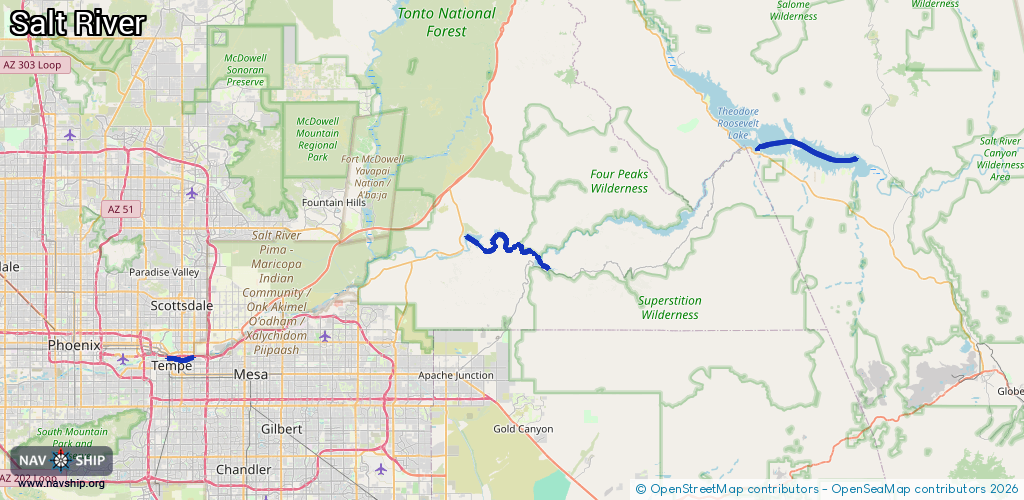
Waterway information

Kind:
Inland
Driving areas:
🇺🇸 United States of America
Length:
34 km¹
¹River kilometers or bank length recorded in NavShip, including river arms and harbor entrances.
Availability:
Completely recorded
Recent Update: 01.03.2024²
² This date indicates when an adjustment last took place in the course of the body of water
Recorded:
Locks: 0
Harbours / marinas: 4
Bridges: 0
Berths: 0
Slipways: 0
Fuelstations: 0
Route:
Please wait, loading route graphic...
Request waterway overview map with symbol legend here (Link).
Information about data associated with this body of water (4 available):
Data by OpenSeaMap (c) OSM contributors, www.openseamap.org
| # | Kind | Coordinates | Name | Information |
|---|---|---|---|---|
| 1 | Marina | 33.53527,-111.42432 | 2022-12-01T06:45:54Z | Canyon Lake Marina |
| 2 | Marina | 33.57229,-111.53738 | 2022-12-01T06:45:54Z | Saguaro Lake Marina |
| 3 | Marina | 33.43424,-111.93282 | 2024-11-07T07:17:26Z | SRP Tempe Town Lake Marina https://www.tempe.gov/Home/Components/FacilityDirectory/FacilityDirectory/170/1209?npage=8 |
| 4 | Marina | 33.67177,-111.13705 | 2022-06-10T20:37:27Z | Roosevelt Lake Marina [email protected] +1-602-977-7170 https://rlmaz.com/ |