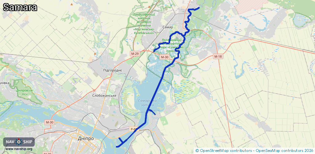
Waterway information

Kind:
Inland
Driving areas:
🇺🇦 Ukraine
Length:
42.2 km¹
¹River kilometers or bank length recorded in NavShip, including river arms and harbor entrances.
Availability:
Completely recorded
Recent Update: 02.05.2025²
² This date indicates when an adjustment last took place in the course of the body of water
Recorded:
Locks: 0
Harbours / marinas: 3
Bridges: 0
Berths: 0
Slipways: 0
Fuelstations: 0
Route:
Please wait, loading route graphic...
Request waterway overview map with symbol legend here (Link).
Information about data associated with this body of water (3 available):
Data by OpenSeaMap (c) OSM contributors, www.openseamap.org
| # | Kind | Coordinates | Name | Information |
|---|---|---|---|---|
| 1 | Marina | 48.49009,35.18153 | 2025-12-01T19:59:09Z | |
| 2 | Marina | 48.62238,35.23534 | 2025-04-25T18:19:51Z | |
| 3 | Marina | 48.46867,35.11563 | 2026-02-22T13:58:36Z |