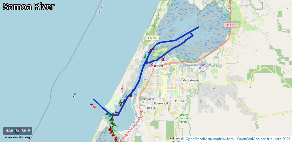
Waterway information

Kind:
Inland
Driving areas:
🌊 Pacific Ocean🇺🇸 United States of America
Length:
22.4 km¹
¹River kilometers or bank length recorded in NavShip, including river arms and harbor entrances.
Availability:
Completely recorded
Recent Update: 17.07.2025²
² This date indicates when an adjustment last took place in the course of the body of water
Recorded:
Locks: 0
Harbours / marinas: 2
Bridges: 0
Berths: 0
Slipways: 0
Fuelstations: 0
Route:
Please wait, loading route graphic...
Request waterway overview map with symbol legend here (Link).
Information about data associated with this body of water (2 available):
Data by OpenSeaMap (c) OSM contributors, www.openseamap.org
| # | Kind | Coordinates | Name | Information |
|---|---|---|---|---|
| 1 | Marina | 40.80843,-124.16285 | 2023-10-24T06:55:16Z | Woodley Island Marina https://humboldtbay.org/woodley-island-marina-0 |
| 2 | Marina | 40.80303,-124.17734 | 2021-05-02T16:54:26Z | Eureka Public Marina https://www.ci.eureka.ca.gov/depts/pnr/harbor_n_marina_operations/marina.asp |