Waterway information

Kind:
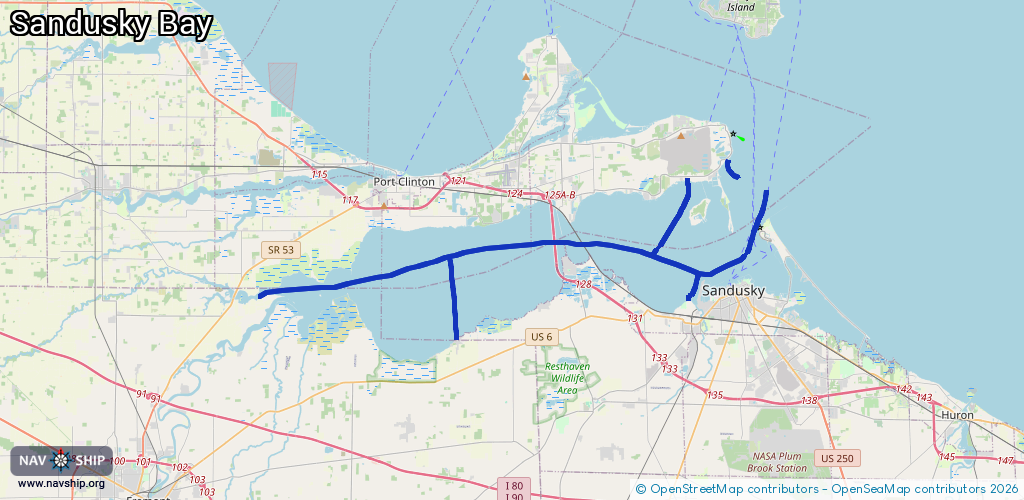
Inland
Driving areas:
🇺🇸 United States of America
Length:
45.5 km¹
¹River kilometers or bank length recorded in NavShip, including river arms and harbor entrances.
Availability:
Completely recorded
Recent Update: 08.04.2025²
² This date indicates when an adjustment last took place in the course of the body of water
Recorded:
Locks: 0
Harbours / marinas: 7
Bridges: 0
Berths: 0
Slipways: 0
Fuelstations: 0
Route:
Please wait, loading route graphic...
Request waterway overview map with symbol legend here (Link).
Information about data associated with this body of water (7 available):
Data by OpenSeaMap (c) OSM contributors, www.openseamap.org
| # | Kind | Coordinates | Name | Information |
|---|---|---|---|---|
| 1 | Marina | 41.45172,-82.74256 | 2015-10-10T13:41:07Z | Sandusky Harbor Marina |
| 2 | Marina | 41.52261,-82.7168 | 2015-10-12T08:52:50Z | Orib Boat Club |
| 3 | Marina | 41.52301,-82.71609 | 2015-10-12T08:52:50Z | Marblehead Marina |
| 4 | Marina | 41.51255,-82.74324 | 2024-08-19T14:06:18Z | Snug Harbor |
| 5 | Marina | 41.43084,-82.90194 | 2021-09-25T01:52:05Z | |
| 6 | Marina | 41.4311,-82.90168 | 2021-09-25T01:52:05Z | |
| 7 | Marina | 41.43076,-82.90275 | 2021-09-25T01:52:05Z |