Waterway information

Kind:
Inland
Driving areas:
🌊 Baltic Sea🇪🇪 Estonia
Length:
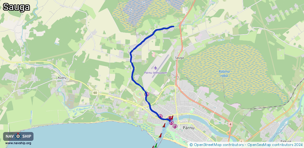
9.6 km¹
¹River kilometers or bank length recorded in NavShip, including river arms and harbor entrances.
Availability:
Completely recorded
Recent Update: 22.12.2023²
² This date indicates when an adjustment last took place in the course of the body of water
Recorded:
Locks: 0
Harbours / marinas: 3
Bridges: 0
Berths: 0
Slipways: 1
Fuelstations: 0
Route:
Please wait, loading route graphic...
Request waterway overview map with symbol legend here (Link).
Information about data associated with this body of water (4 available):
Data by OpenSeaMap (c) OSM contributors, www.openseamap.org
| # | Kind | Coordinates | Name | Information |
|---|---|---|---|---|
| 1 | Marina | 58.40376,24.45968 | 2023-01-23T13:45:00Z | Sauga sadam +372 5097841 https://fishingvillage.ee/sadam/ |
| 2 | Marina | 58.39013,24.47541 | 2026-01-28T21:36:02Z | Vana-Sauga Sadam [email protected] +372 4443170 |
| 3 | Marina | 58.38914,24.487 | 2026-01-28T21:32:00Z | Japsi sadam +372 4459600 https://japs.ee/ |
| 4 | Slipway | 58.38997,24.47511 | Unknown | 2026-01-28T21:32:00Z |