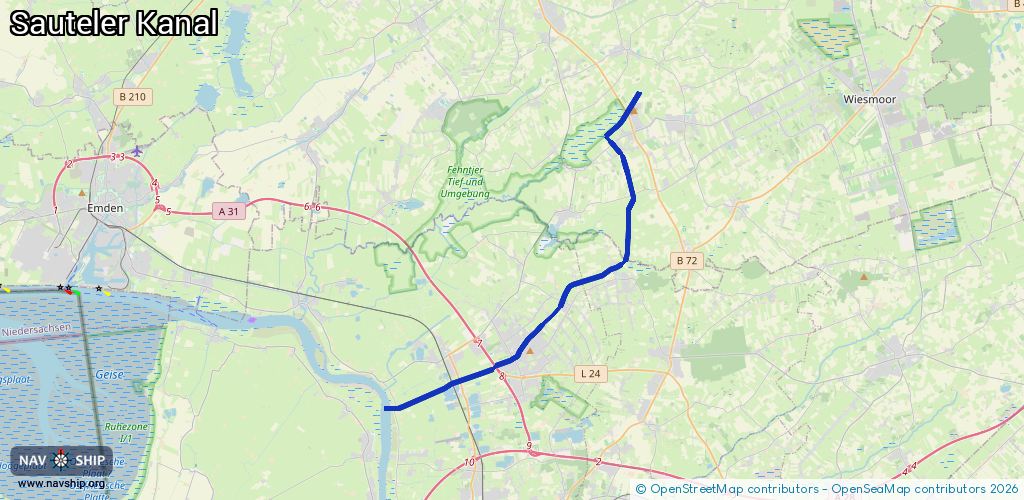
Waterway information

Kind:
Inland
Driving areas:
🇩🇪 Germany
Length:
22.1 km¹
¹River kilometers or bank length recorded in NavShip, including river arms and harbor entrances.
Availability:
Completely recorded
Recent Update: 10.01.2023²
² This date indicates when an adjustment last took place in the course of the body of water
Recorded:
Locks: 0
Harbours / marinas: 1
Bridges: 1
Berths: 0
Slipways: 0
Fuelstations: 0
Route:
Please wait, loading route graphic...
Request waterway overview map with symbol legend here (Link).
Information about data associated with this body of water (2 available):
Data by OpenSeaMap (c) OSM contributors, www.openseamap.org
| # | Kind | Coordinates | Name | Information |
|---|---|---|---|---|
| 1 | Marina | 53.28506,7.40303 | 2025-03-12T10:39:35Z | Yacht-Club Sautelersiel e.V. +49 152 0594 4134 https://yachtclub-sautelersiel.de |
| 2 | Bridge | 53.29516,7.4441 | Unknown | Clearance height: 2014-04-30T15:01:04Z m Maximum passage width: 0.3 m fixed |