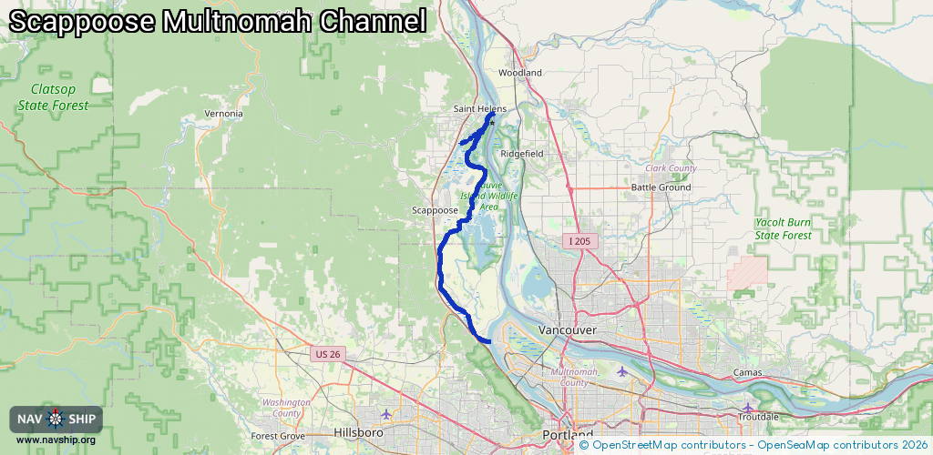
Waterway information

Kind:
Inland
Driving areas:
🇺🇸 United States of America
Length:
38 km¹
¹River kilometers or bank length recorded in NavShip, including river arms and harbor entrances.
Availability:
Completely recorded
Recent Update: 10.04.2025²
² This date indicates when an adjustment last took place in the course of the body of water
Recorded:
Locks: 0
Harbours / marinas: 5
Bridges: 0
Berths: 0
Slipways: 0
Fuelstations: 0
Route:
Please wait, loading route graphic...
Request waterway overview map with symbol legend here (Link).
Information about data associated with this body of water (5 available):
Data by OpenSeaMap (c) OSM contributors, www.openseamap.org
| # | Kind | Coordinates | Name | Information |
|---|---|---|---|---|
| 1 | Marina | 45.82829,-122.83784 | 2021-09-01T22:51:39Z | Scappoose Bay Marina |
| 2 | Marina | 45.69824,-122.86962 | 2023-08-25T18:48:17Z | |
| 3 | Marina | 45.70553,-122.86916 | 2023-08-25T18:48:17Z | |
| 4 | Marina | 45.72865,-122.86098 | 2022-07-13T19:11:02Z | Brown Landing |
| 5 | Marina | 45.73068,-122.85985 | 2022-07-13T19:11:02Z | Lighthouse Marina |