Waterway information

Kind:
Inland
Driving areas:
🇳🇱 Netherlands
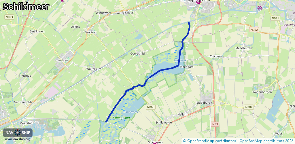
Length:
11.6 km¹
¹River kilometers or bank length recorded in NavShip, including river arms and harbor entrances.
Availability:
Completely recorded
Recent Update: 08.05.2019²
² This date indicates when an adjustment last took place in the course of the body of water
Recorded:
Locks: 0
Harbours / marinas: 0
Bridges: 7
Berths: 0
Slipways: 0
Fuelstations: 0
Route:
Please wait, loading route graphic...
Request waterway overview map with symbol legend here (Link).
Information about data associated with this body of water (7 available):
Data by OpenSeaMap (c) OSM contributors, www.openseamap.org
| # | Kind | Coordinates | Name | Information |
|---|---|---|---|---|
| 1 | Bridge | 53.30396,6.84593 | 6 | Clearance height: 2019-02-10T19:32:03Z m Maximum passage width: 1 m Movable bridge (e.g. lifting bridge or drawbridge) opening |
| 2 | Bridge | 53.29036,6.83814 | 6.60 | Clearance height: 2013-02-20T15:25:58Z m Maximum passage width: 1 m Movable bridge (e.g. lifting bridge or drawbridge) opening |
| 3 | Bridge | 53.26303,6.79535 | 5.5 | Clearance height: 2020-06-22T10:55:30Z m Maximum passage width: 2.5 m Movable bridge (e.g. lifting bridge or drawbridge) opening |
| 4 | Bridge | 53.25845,6.77994 | 19 | Clearance height: 2020-06-22T10:55:30Z m Maximum passage width: 2.7 m Movable bridge (e.g. lifting bridge or drawbridge) fixed |
| 5 | Bridge | 53.25162,6.76749 | 15.90 | Clearance height: 2020-06-22T10:55:30Z m Maximum passage width: 2.5 m Movable bridge (e.g. lifting bridge or drawbridge) fixed |
| 6 | Bridge | 53.24304,6.7569 | 14.40 | Clearance height: 2013-02-19T16:00:27Z m Maximum passage width: 2.50 m Movable bridge (e.g. lifting bridge or drawbridge) fixed |
| 7 | Bridge | 53.23339,6.74694 | 7.50 | Clearance height: 2019-11-16T11:36:09Z m Maximum passage width: 2.50 m Movable bridge (e.g. lifting bridge or drawbridge) fixed |