Waterway information

Kind:
Inland
Driving areas:
🇩🇪 Germany
Length:
0.9 km¹
¹River kilometers or bank length recorded in NavShip, including river arms and harbor entrances.
Availability:
Completely recorded
Recent Update: 09.07.2024²
² This date indicates when an adjustment last took place in the course of the body of water
Recorded:
Locks: 0
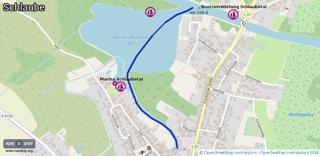
Harbours / marinas: 2
Bridges: 0
Berths: 0
Slipways: 0
Fuelstations: 0
Route:
Please wait, loading route graphic...
Request waterway overview map with symbol legend here (Link).
Information about data associated with this body of water (2 available):
Data by OpenSeaMap (c) OSM contributors, www.openseamap.org
| # | Kind | Coordinates | Name | Information |
|---|---|---|---|---|
| 1 | Marina | 52.24906,14.41211 | 2023-11-08T01:25:48Z | Marina Schlaubetal [email protected] +49 174 9902708 https://www.marina-schlaubetal.de/ |
| 2 | Marina | 52.2522,14.41416 | 2016-06-24T11:19:02Z | Motoryachtclub Eisenhüttenstadt e.V. Stützpunkt Müllrose Wasserwanderrastplatz mit Bootsanleger und Zeltmöglichkeit. Ausgedehnte Steganlage kein Stromnetz, Wasserversorgung, Abwasser. Nutzbar Trockentoilette, Wasser-Handpumpe Brauchwasser |