Waterway information

Kind:
Inland
Driving areas:
🇩🇪 Germany
Length:
0.8 km¹
¹River kilometers or bank length recorded in NavShip, including river arms and harbor entrances.
Availability:
Completely recorded
Recent Update: 24.08.2020²
² This date indicates when an adjustment last took place in the course of the body of water
Recorded:
Locks: 0
Harbours / marinas: 4
Bridges: 0
Berths: 0
Slipways: 0
Fuelstations: 0
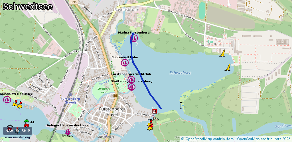
Route:
Please wait, loading route graphic...
Request waterway overview map with symbol legend here (Link).
Information about data associated with this body of water (4 available):
Data by OpenSeaMap (c) OSM contributors, www.openseamap.org
| # | Kind | Coordinates | Name | Information |
|---|---|---|---|---|
| 1 | Marina | 53.19186,13.14895 | 2013-09-25T10:49:44Z | Marina Fürstenberg [email protected] +49 33093 35123 http://www.mar ina-fürstenberg.de |
| 2 | Marina | 53.18965,13.14757 | 2019-03-05T11:03:34Z | Bootswerft Palm +49 33093 37863 https://www.bootswerft-palm.de/ |
| 3 | Marina | 53.18811,13.14855 | 2019-03-14T17:55:29Z | Fürstenberger Yachtclub +49 33093 39206 https://www.fbgy.de/ |
| 4 | Marina | 53.18746,13.1486 | 2019-09-08T15:26:25Z | Stadtanleger Fürstenberg |