Waterway information

Kind:
Inland
Driving areas:
🇷🇺 Russia
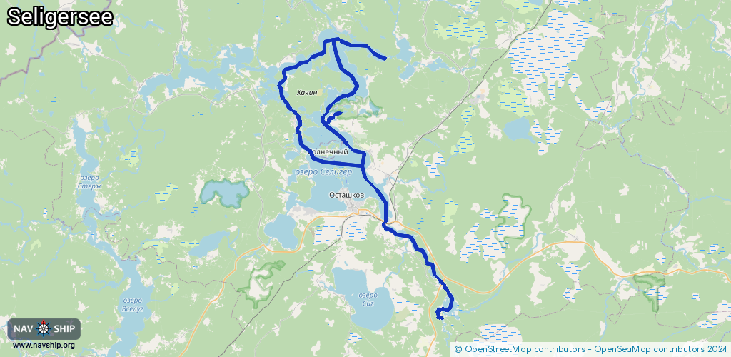
Length:
83.7 km¹
¹River kilometers or bank length recorded in NavShip, including river arms and harbor entrances.
Availability:
Completely recorded
Recent Update: 06.01.2025²
² This date indicates when an adjustment last took place in the course of the body of water
Recorded:
Locks: 0
Harbours / marinas: 12
Bridges: 0
Berths: 0
Slipways: 0
Fuelstations: 0
Route:
Please wait, loading route graphic...
Request waterway overview map with symbol legend here (Link).
Information about data associated with this body of water (12 available):
Data by OpenSeaMap (c) OSM contributors, www.openseamap.org
| # | Kind | Coordinates | Name | Information |
|---|---|---|---|---|
| 1 | Marina | 57.23655,33.06774 | 2023-11-05T18:12:55Z | |
| 2 | Marina | 57.23619,33.06927 | 2022-09-28T14:37:37Z | |
| 3 | Marina | 57.23621,33.06915 | 2022-09-28T14:37:37Z | |
| 4 | Marina | 57.23614,33.06962 | 2022-09-28T14:37:37Z | |
| 5 | Marina | 57.23611,33.06975 | 2022-09-28T14:37:37Z | |
| 6 | Marina | 57.23614,33.06985 | 2022-09-28T14:37:37Z | |
| 7 | Marina | 57.23654,33.0675 | 2023-11-05T18:12:52Z | |
| 8 | Marina | 57.23653,33.06732 | 2023-11-05T18:12:48Z | |
| 9 | Marina | 57.23651,33.06719 | 2023-11-05T18:12:44Z | |
| 10 | Marina | 57.23647,33.06705 | 2023-11-05T18:12:42Z | |
| 11 | Marina | 57.20078,33.1362 | 2022-09-28T11:43:14Z | |
| 12 | Marina | 57.16477,33.09504 | 2024-12-30T09:44:53Z | стоянка лодок |