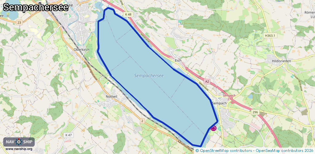
Waterway information

Kind:
Lake
Driving areas:
🇨🇭 Switzerland
Length:
16.2 km¹
¹River kilometers or bank length recorded in NavShip, including river arms and harbor entrances.
Availability:
Completely recorded
Recent Update: 10.08.2023²
² This date indicates when an adjustment last took place in the course of the body of water
Recorded:
Locks: 0
Harbours / marinas: 2
Bridges: 0
Berths: 0
Slipways: 7
Fuelstations: 0
Route:
Please wait, loading route graphic...
Request waterway overview map with symbol legend here (Link).
Information about data associated with this body of water (9 available):
Data by OpenSeaMap (c) OSM contributors, www.openseamap.org
| # | Kind | Coordinates | Name | Information |
|---|---|---|---|---|
| 1 | Marina | 47.12578,8.18851 | 2023-11-14T12:34:08Z | |
| 2 | Marina | 47.12576,8.18888 | 2023-11-14T12:34:08Z | |
| 3 | Slipway | 47.1737,8.12607 | small_craft_facility | 2017-01-04T12:11:37Z |
| 4 | Slipway | 47.17104,8.1338 | Unknown | 2013-07-04T15:28:48Z |
| 5 | Slipway | 47.17102,8.13377 | small_craft_facility | 2017-01-04T12:11:37Z |
| 6 | Slipway | 47.12568,8.18922 | small_craft_facility | 2017-01-04T12:11:38Z |
| 7 | Slipway | 47.11965,8.17436 | small_craft_facility | 2017-01-04T12:32:01Z |
| 8 | Slipway | 47.12387,8.16729 | Unknown | 2025-05-22T08:30:25Z |
| 9 | Slipway | 47.12388,8.16735 | small_craft_facility | 2017-01-04T12:22:45Z |