Waterway information

Kind:
Inland
Driving areas:
🇺🇸 United States of America
Length:
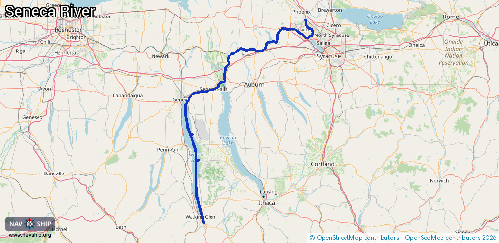
155.7 km¹
¹River kilometers or bank length recorded in NavShip, including river arms and harbor entrances.
Availability:
Completely recorded
Recent Update: 27.02.2024²
² This date indicates when an adjustment last took place in the course of the body of water
Recorded:
Locks: 3
Harbours / marinas: 3
Bridges: 0
Berths: 0
Slipways: 2
Fuelstations: 0
Route:
Please wait, loading route graphic...
Request waterway overview map with symbol legend here (Link).
Information about data associated with this body of water (8 available):
Data by OpenSeaMap (c) OSM contributors, www.openseamap.org
| # | Kind | Coordinates | Name | Information |
|---|---|---|---|---|
| 1 | Marina | 43.12774,-76.25789 | 2024-01-22T15:42:11Z | |
| 2 | Marina | 42.38419,-76.87343 | 2024-01-15T16:19:20Z | |
| 3 | Marina | 42.72605,-76.91317 | 2021-02-12T22:11:08Z | |
| 4 | Slipway | 42.61787,-76.87694 | Unknown | 2025-05-01T14:37:52Z Lodi Point State Park Boat Launch |
| 5 | Slipway | 42.38401,-76.87279 | Unknown | 2024-01-15T16:19:20Z |
| 6 | Lock | 43.15588,-76.33295 | Unknown | |
| 7 | Lock | 42.94796,-76.73442 | Unknown | |
| 8 | Lock | 42.90124,-76.86371 | Unknown |