Waterway information

Kind:
Inland
Driving areas:
🇩🇪 Germany
Length:
7 km¹
¹River kilometers or bank length recorded in NavShip, including river arms and harbor entrances.
Availability:
Completely recorded
Recent Update: 22.04.2025²
² This date indicates when an adjustment last took place in the course of the body of water
Recorded:
Locks: 0
Harbours / marinas: 2
Bridges: 0
Berths: 0
Slipways: 2
Fuelstations: 1
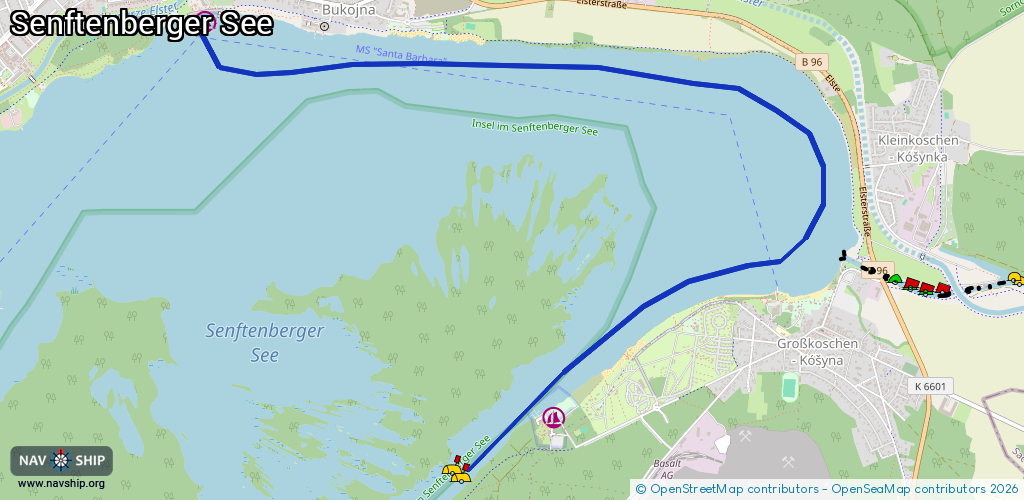
Route:
Please wait, loading route graphic...
Request waterway overview map with symbol legend here (Link).
Information about data associated with this body of water (5 available):
Data by OpenSeaMap (c) OSM contributors, www.openseamap.org
| # | Kind | Coordinates | Name | Information |
|---|---|---|---|---|
| 1 | Marina | 51.51219,14.00661 | 2023-02-06T07:28:31Z | Stadthafen Senftenberg https://www.stadthafen-senftenberg.de |
| 2 | Marina | 51.49101,14.03756 | 2025-12-15T12:17:16Z | |
| 3 | Slipway | 51.51291,14.00836 | Unknown | 2025-10-26T15:19:38Z |
| 4 | Slipway | 51.51296,14.00839 | small_craft_facility | 2025-10-26T15:19:38Z |
| 5 | Fuel station | 51.51296,14.00854 | 2024-02-05T15:22:01Z |