Waterway information

Kind:
Inland
Driving areas:
🇬🇧 United Kingdom
Length:
6.2 km¹
¹River kilometers or bank length recorded in NavShip, including river arms and harbor entrances.
Availability:
Completely recorded
Recent Update: 04.03.2025²
² This date indicates when an adjustment last took place in the course of the body of water
Recorded:
Locks: 11
Harbours / marinas: 2
Bridges: 2
Berths: 2
Slipways: 1
Fuelstations: 0
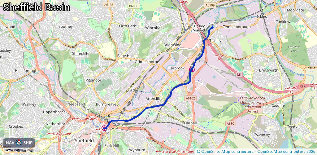
Route:
Please wait, loading route graphic...
Request waterway overview map with symbol legend here (Link).
Information about data associated with this body of water (7 available):
Data by OpenSeaMap (c) OSM contributors, www.openseamap.org
| # | Kind | Coordinates | Name | Information |
|---|---|---|---|---|
| 1 | Marina | 53.40407,-1.41055 | 2013-01-07T22:33:41Z | Tinsley Marina |
| 2 | Marina | 53.38471,-1.45905 | 2017-09-05T16:54:25Z | Sheffield Basin +44 1924 467 976 |
| 3 | Bridge | 53.38519,-1.45757 | Unknown | Clearance height: 2023-10-13T23:30:18Z m swing |
| 4 | Bridge | 53.3852,-1.45761 | Unknown | Clearance height: 2024-04-14T09:48:42Z m swing |
| 5 | Slipway | 53.38728,-1.45476 | small_craft_facility | 2016-12-13T14:51:32Z |
| 6 | Berth | 53.38538,-1.45772 | 2023-10-13T23:30:18Z | |
| 7 | Berth | 53.38499,-1.4584 | 2016-12-13T14:51:31Z | |
| 7 | Berth | 53.38499,-1.4584 | 2016-12-13T14:51:31Z | |
| 7 | Berth | 53.38499,-1.4584 | 2016-12-13T14:51:31Z | |
| 7 | Berth | 53.38499,-1.4584 | 2016-12-13T14:51:31Z | |
| 7 | Berth | 53.38499,-1.4584 | 2016-12-13T14:51:31Z | |
| 7 | Berth | 53.38499,-1.4584 | 2016-12-13T14:51:31Z | |
| 7 | Berth | 53.38499,-1.4584 | 2016-12-13T14:51:31Z | |
| 7 | Berth | 53.38499,-1.4584 | 2016-12-13T14:51:31Z | |
| 7 | Berth | 53.38499,-1.4584 | 2016-12-13T14:51:31Z | |
| 7 | Berth | 53.38499,-1.4584 | 2016-12-13T14:51:31Z | |
| 7 | Berth | 53.38499,-1.4584 | 2016-12-13T14:51:31Z | |
| 7 | Berth | 53.38499,-1.4584 | 2016-12-13T14:51:31Z |