Waterway information

Kind:
Inland
Driving areas:
🌊 Atlantic Ocean🇺🇸 United States of America
Length:
1.3 km¹
¹River kilometers or bank length recorded in NavShip, including river arms and harbor entrances.
Availability:
Completely recorded
Recent Update: 18.01.2024²
² This date indicates when an adjustment last took place in the course of the body of water
Recorded:
Locks: 0
Harbours / marinas: 1
Bridges: 0
Berths: 0
Slipways: 11
Fuelstations: 2
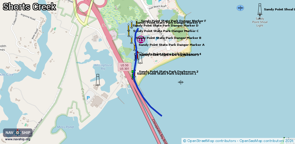
Route:
Please wait, loading route graphic...
Request waterway overview map with symbol legend here (Link).
Information about data associated with this body of water (14 available):
Data by OpenSeaMap (c) OSM contributors, www.openseamap.org
| # | Kind | Coordinates | Name | Information |
|---|---|---|---|---|
| 1 | Marina | 39.013,-76.40231 | 2021-10-31T04:44:41Z | Sandy Point State Park public |
| 2 | Slipway | 39.01319,-76.40097 | small_craft_facility | 2021-10-11T02:28:20Z Sandy Point State Park |
| 3 | Slipway | 39.0133,-76.40099 | small_craft_facility | 2021-10-11T02:28:20Z Sandy Point State Park |
| 4 | Slipway | 39.01342,-76.40102 | small_craft_facility | 2021-10-11T02:28:20Z Sandy Point State Park |
| 5 | Slipway | 39.01284,-76.4009 | small_craft_facility | 2021-10-11T02:28:20Z Sandy Point State Park |
| 6 | Slipway | 39.01296,-76.40092 | small_craft_facility | 2021-10-11T02:28:20Z Sandy Point State Park |
| 7 | Slipway | 39.01307,-76.40094 | small_craft_facility | 2021-10-11T02:28:20Z Sandy Point State Park |
| 8 | Slipway | 39.01225,-76.40078 | small_craft_facility | 2021-10-11T02:28:20Z Sandy Point State Park |
| 9 | Slipway | 39.01238,-76.40081 | small_craft_facility | 2021-10-11T02:28:20Z Sandy Point State Park |
| 10 | Slipway | 39.0125,-76.40083 | small_craft_facility | 2021-10-11T02:28:20Z Sandy Point State Park |
| 11 | Slipway | 39.01262,-76.40085 | small_craft_facility | 2021-10-11T02:28:20Z Sandy Point State Park |
| 12 | Slipway | 39.01273,-76.40087 | small_craft_facility | 2021-10-11T02:28:20Z Sandy Point State Park |
| 13 | Fuel station | 39.01343,-76.40223 | 2021-10-11T02:28:20Z | |
| 14 | Fuel station | 39.01342,-76.40228 | 2021-10-11T02:28:20Z |