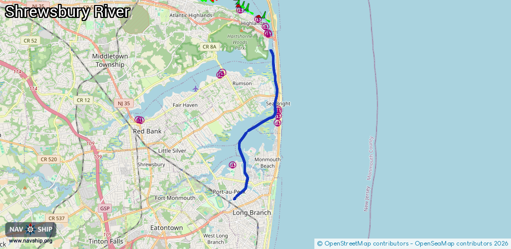
Waterway information

Kind:
Inland
Driving areas:
🌊 Atlantic Ocean🇺🇸 United States of America
Length:
10.3 km¹
¹River kilometers or bank length recorded in NavShip, including river arms and harbor entrances.
Availability:
Completely recorded
Recent Update: 06.02.2024²
² This date indicates when an adjustment last took place in the course of the body of water
Recorded:
Locks: 0
Harbours / marinas: 5
Bridges: 0
Berths: 0
Slipways: 0
Fuelstations: 0
Route:
Please wait, loading route graphic...
Request waterway overview map with symbol legend here (Link).
Information about data associated with this body of water (5 available):
Data by OpenSeaMap (c) OSM contributors, www.openseamap.org
| # | Kind | Coordinates | Name | Information |
|---|---|---|---|---|
| 1 | Marina | 40.32926,-74.0055 | 2024-10-06T01:50:24Z | |
| 2 | Marina | 40.35126,-73.97465 | 2023-06-26T17:49:30Z | Navesink Marina |
| 3 | Marina | 40.35499,-73.97428 | 2025-08-04T00:52:15Z | Angler's Marina |
| 4 | Marina | 40.35727,-73.97443 | 2025-08-04T00:52:15Z | Coversail Marina |
| 5 | Marina | 40.35831,-73.97458 | 2025-08-04T00:52:15Z | Carriage House Marina |