Waterway information

Kind:
Inland
Driving areas:
🇫🇮 Finland
Length:
4.3 km¹
¹River kilometers or bank length recorded in NavShip, including river arms and harbor entrances.
Availability:
Completely recorded
Recent Update: 15.01.2025²
² This date indicates when an adjustment last took place in the course of the body of water
Recorded:
Locks: 0
Harbours / marinas: 5
Bridges: 0
Berths: 0
Slipways: 0
Fuelstations: 0
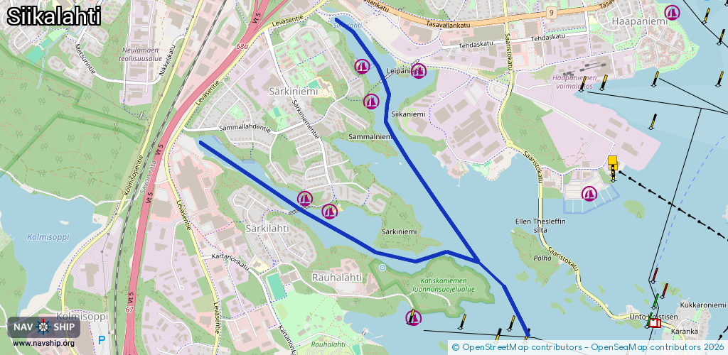
Route:
Please wait, loading route graphic...
Request waterway overview map with symbol legend here (Link).
Information about data associated with this body of water (5 available):
Data by OpenSeaMap (c) OSM contributors, www.openseamap.org
| # | Kind | Coordinates | Name | Information |
|---|---|---|---|---|
| 1 | Marina | 62.87934,27.64605 | 2025-01-08T06:19:59Z | Siikalahden venesatama |
| 2 | Marina | 62.87902,27.65308 | 2025-01-08T06:19:59Z | Leipäniemen veneranta |
| 3 | Marina | 62.87732,27.64749 | 2025-01-08T06:19:59Z | Sammalniemen veneranta |
| 4 | Marina | 62.87129,27.64231 | 2025-02-23T10:42:23Z | Särkiniemen veneranta |
| 5 | Marina | 62.872,27.63934 | 2025-01-08T06:19:59Z | Nurmitien veneranta |