Waterway information

Kind:
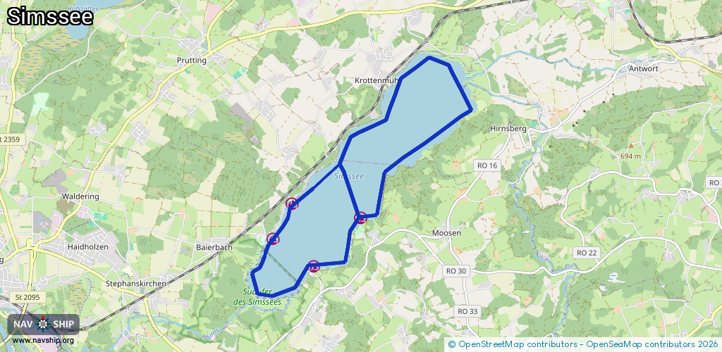
Lake
Driving areas:
🇩🇪 Germany
Length:
13.8 km¹
¹River kilometers or bank length recorded in NavShip, including river arms and harbor entrances.
Availability:
Completely recorded
Recent Update: 22.02.2026²
² This date indicates when an adjustment last took place in the course of the body of water
Recorded:
Locks: 0
Harbours / marinas: 4
Bridges: 0
Berths: 0
Slipways: 4
Fuelstations: 0
Route:
Please wait, loading route graphic...
Request waterway overview map with symbol legend here (Link).
Information about data associated with this body of water (8 available):
Data by OpenSeaMap (c) OSM contributors, www.openseamap.org
| # | Kind | Coordinates | Name | Information |
|---|---|---|---|---|
| 1 | Marina | 47.85814,12.22759 | 2020-02-16T18:33:24Z | SBV Simssee Ecking Bojenliegeplätze Ecking |
| 2 | Marina | 47.86585,12.23891 | 2023-10-02T06:14:29Z | SBV Simssee Pietzing Bojenliegeplätze Pietzing |
| 3 | Marina | 47.86837,12.22232 | 2020-02-16T18:33:24Z | Segler- und Ruderclub Simssee |
| 4 | Marina | 47.86284,12.2171 | 2020-09-27T16:10:20Z | SBV Simssee Baierbach Bojenliegeplätze Baierbach |
| 5 | Slipway | 47.86576,12.24077 | small_craft_facility | 2020-04-26T14:36:19Z |
| 6 | Slipway | 47.86559,12.23878 | small_craft_facility | 2020-09-27T15:30:27Z |
| 7 | Slipway | 47.86858,12.22216 | small_craft_facility | 2020-04-26T14:36:19Z |
| 8 | Slipway | 47.863,12.21654 | small_craft_facility | 2020-04-26T14:36:19Z |