Waterway information

Kind:
Inland
Driving areas:
🇭🇺 Hungary
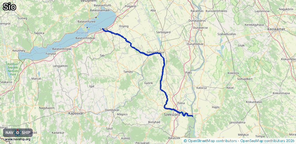
Length:
121.7 km¹
¹River kilometers or bank length recorded in NavShip, including river arms and harbor entrances.
Availability:
Completely recorded
Recent Update: 28.03.2025²
² This date indicates when an adjustment last took place in the course of the body of water
Recorded:
Locks: 2
Harbours / marinas: 2
Bridges: 3
Berths: 0
Slipways: 0
Fuelstations: 0
Route:
Please wait, loading route graphic...
Request waterway overview map with symbol legend here (Link).
Information about data associated with this body of water (7 available):
Data by OpenSeaMap (c) OSM contributors, www.openseamap.org
| # | Kind | Coordinates | Name | Information |
|---|---|---|---|---|
| 1 | Marina | 46.91152,18.04267 | 2024-05-18T14:39:34Z | Siófoki vitorlás kikötő |
| 2 | Marina | 46.90905,18.04621 | 2025-10-21T18:50:17Z | Siófok |
| 3 | Bridge | 46.90621,18.04792 | 22 | Clearance height: 2024-12-12T09:51:18Z m Maximum passage width: 5 m fixed |
| 4 | Bridge | 46.90598,18.04806 | 22 | Clearance height: 2024-12-12T09:51:18Z m Maximum passage width: 5 m fixed |
| 5 | Bridge | 46.90511,18.04858 | 22 | Clearance height: 2024-12-12T09:51:18Z m Maximum passage width: 5 m fixed |
| 6 | Lock | 46.34133,18.86121 | Unknown | |
| 7 | Lock | 46.90797,18.04523 | Unknown |