Waterway information

Kind:
Inland
Driving areas:
🇸🇮 Slovenia
Length:
31.6 km¹
¹River kilometers or bank length recorded in NavShip, including river arms and harbor entrances.
Availability:
Completely recorded
Recent Update: 02.08.2023²
² This date indicates when an adjustment last took place in the course of the body of water
Recorded:
Locks: 0
Harbours / marinas: 2
Bridges: 3
Berths: 5
Slipways: 2
Fuelstations: 0
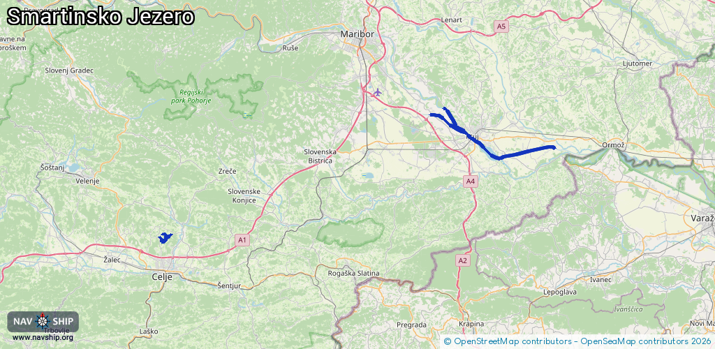
Route:
Please wait, loading route graphic...
Request waterway overview map with symbol legend here (Link).
Information about data associated with this body of water (12 available):
Data by OpenSeaMap (c) OSM contributors, www.openseamap.org
| # | Kind | Coordinates | Name | Information |
|---|---|---|---|---|
| 1 | Marina | 46.27638,15.2592 | 2025-12-20T14:51:59Z | Luka Sailor |
| 2 | Marina | 46.41072,15.88809 | 2024-02-09T22:29:20Z | Marina Ranca |
| 3 | Bridge | 46.27907,15.25908 | Unknown | Clearance height: 2022-05-01T16:35:37Z m Maximum passage width: 1 m fixed |
| 4 | Bridge | 46.27956,15.26107 | Unknown | Clearance height: 2022-05-01T16:35:37Z m Maximum passage width: 1 m fixed |
| 5 | Bridge | 46.27931,15.26001 | Unknown | Clearance height: 2025-12-20T14:51:59Z m Maximum passage width: 2 m fixed |
| 6 | Slipway | 46.4104,15.88791 | small_craft_facility | 2022-08-31T12:05:58Z |
| 7 | Slipway | 46.41061,15.88913 | Unknown | 2024-02-09T22:29:20Z |
| 8 | Berth | 46.27913,15.26102 | 2022-04-28T07:51:37Z | small_craft_mooring |
| 9 | Berth | 46.28242,15.27046 | 2022-04-28T07:51:37Z | small_craft |
| 10 | Berth | 46.27763,15.26504 | 2022-04-28T07:51:37Z | small_craft |
| 11 | Berth | 46.27661,15.27004 | 2022-04-28T07:51:37Z | small_craft_mooring |
| 12 | Berth | 46.27607,15.25933 | 2022-04-28T07:51:37Z |