Waterway information

Kind:
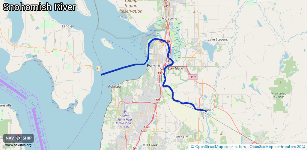
Inland
Driving areas:
🇺🇸 United States of America
Length:
54 km¹
¹River kilometers or bank length recorded in NavShip, including river arms and harbor entrances.
Availability:
Completely recorded
Recent Update: 24.03.2025²
² This date indicates when an adjustment last took place in the course of the body of water
Recorded:
Locks: 0
Harbours / marinas: 4
Bridges: 0
Berths: 0
Slipways: 0
Fuelstations: 1
Route:
Please wait, loading route graphic...
Request waterway overview map with symbol legend here (Link).
Information about data associated with this body of water (5 available):
Data by OpenSeaMap (c) OSM contributors, www.openseamap.org
| # | Kind | Coordinates | Name | Information |
|---|---|---|---|---|
| 1 | Marina | 48.01583,-122.17887 | 2021-04-08T06:02:05Z | Dagmar's Marina |
| 2 | Marina | 48.00263,-122.22211 | 2025-03-16T20:17:41Z | 12th Street Marina |
| 3 | Marina | 47.99647,-122.21932 | 2025-03-16T20:17:41Z | Everett Marina |
| 4 | Marina | 48.03347,-122.18608 | 2025-03-16T20:17:41Z | Seacrest Marina https://www.seacrestmarina.com/ |
| 5 | Fuel station | 47.99809,-122.22303 | 2016-02-08T07:03:33Z |