Waterway information

Kind:
Inland
Driving areas:
🇦🇺 Australia🌊 Pacific Ocean
Length:
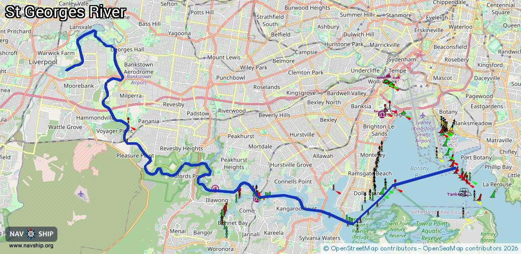
41.6 km¹
¹River kilometers or bank length recorded in NavShip, including river arms and harbor entrances.
Availability:
Completely recorded
Recent Update: 05.09.2024²
² This date indicates when an adjustment last took place in the course of the body of water
Recorded:
Locks: 0
Harbours / marinas: 2
Bridges: 0
Berths: 0
Slipways: 1
Fuelstations: 0
Route:
Please wait, loading route graphic...
Request waterway overview map with symbol legend here (Link).
Information about data associated with this body of water (3 available):
Data by OpenSeaMap (c) OSM contributors, www.openseamap.org
| # | Kind | Coordinates | Name | Information |
|---|---|---|---|---|
| 1 | Marina | -33.99123,151.04173 | 2025-03-03T21:37:22Z | Lugarno Marina and Boatshed http://www.lugarnomarina.com.au/ |
| 2 | Marina | -33.9968,151.06972 | 2022-02-15T12:09:21Z | Como Marina https://comomarina.com.au/ |
| 3 | Slipway | -33.93064,150.96838 | small_craft_facility | 2013-07-29T13:44:01Z |