Waterway information

Kind:
Inland
Driving areas:
🇨🇦 Canada🌊 Pacific Ocean
Length:
96 km¹
¹River kilometers or bank length recorded in NavShip, including river arms and harbor entrances.
Availability:
Completely recorded
Recent Update: 08.04.2025²
² This date indicates when an adjustment last took place in the course of the body of water
Recorded:
Locks: 0
Harbours / marinas: 5
Bridges: 0
Berths: 0
Slipways: 2
Fuelstations: 0
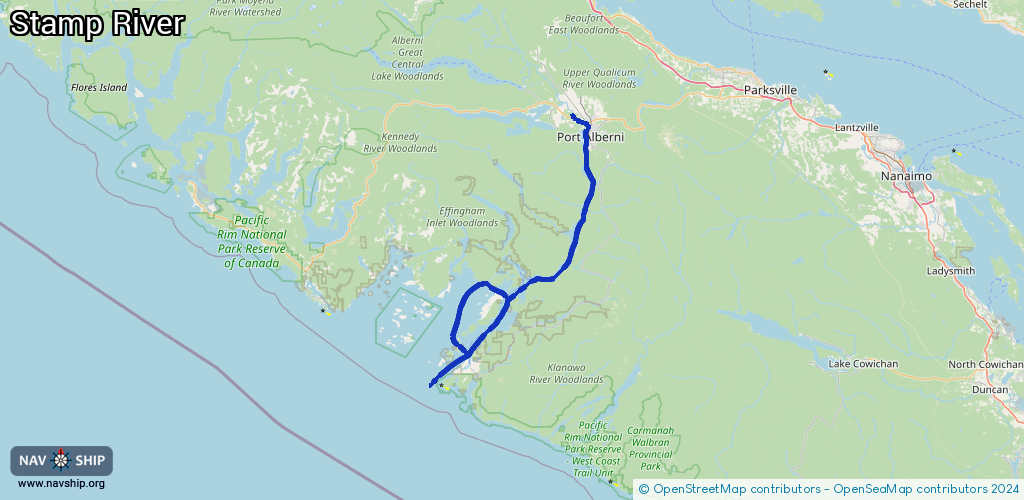
Route:
Please wait, loading route graphic...
Request waterway overview map with symbol legend here (Link).
Information about data associated with this body of water (7 available):
Data by OpenSeaMap (c) OSM contributors, www.openseamap.org
| # | Kind | Coordinates | Name | Information |
|---|---|---|---|---|
| 1 | Marina | 49.23657,-124.81204 | 2024-02-24T03:55:33Z | Fishermen's Harbour |
| 2 | Marina | 49.23221,-124.8131 | 2024-11-18T06:33:56Z | Harbour Quay Marina |
| 3 | Marina | 49.23243,-124.81365 | 2024-02-26T06:51:47Z | |
| 4 | Marina | 49.15254,-124.79449 | 2025-11-26T19:54:01Z | China Creek Campground and Marina +1-250-723-9812 https://campchinacreek.com/,https://campchinacreek.com/ |
| 5 | Marina | 48.83783,-125.13898 | 2022-05-07T18:13:06Z | Tyee Lodge Marina |
| 6 | Slipway | 49.15336,-124.79556 | small_craft_facility | 2016-06-17T00:46:57Z by car |
| 7 | Slipway | 49.15335,-124.7957 | small_craft_facility | 2013-05-12T15:20:05Z by car |