Waterway information

Kind:
Inland
Driving areas:
🇳🇱 Netherlands🌊 North Sea
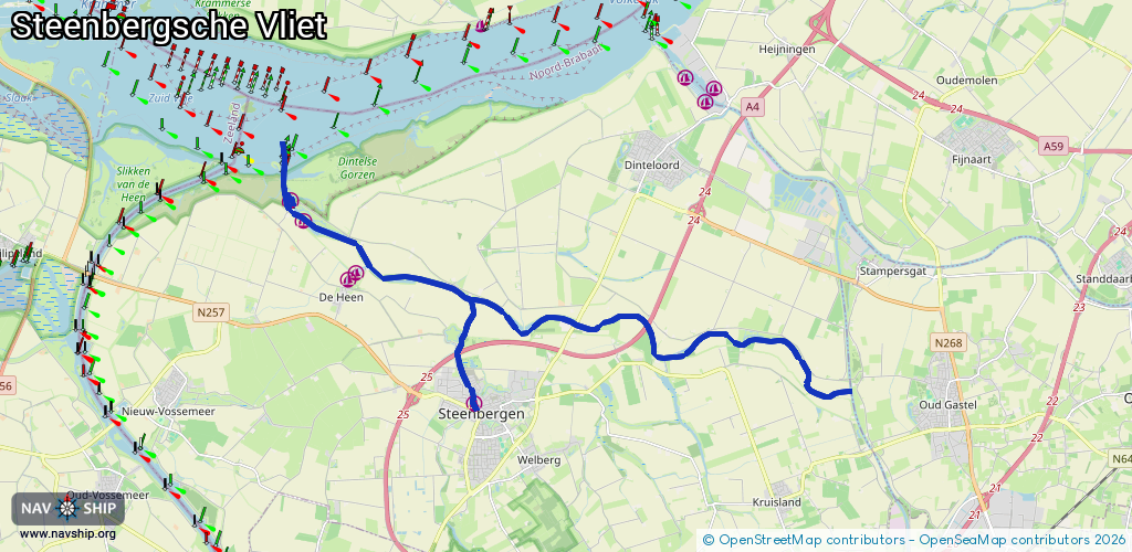
Length:
19.3 km¹
¹River kilometers or bank length recorded in NavShip, including river arms and harbor entrances.
Availability:
Completely recorded
Recent Update: 27.02.2026²
² This date indicates when an adjustment last took place in the course of the body of water
Recorded:
Locks: 2
Harbours / marinas: 5
Bridges: 3
Berths: 0
Slipways: 0
Fuelstations: 0
Route:
Please wait, loading route graphic...
Request waterway overview map with symbol legend here (Link).
Information about data associated with this body of water (10 available):
Data by OpenSeaMap (c) OSM contributors, www.openseamap.org
| # | Kind | Coordinates | Name | Information |
|---|---|---|---|---|
| 1 | Marina | 51.61172,4.27365 | 2024-08-22T21:48:30Z | Jachthaven de Schapenput https://www.schapenput.nl/ |
| 2 | Marina | 51.61278,4.27574 | 2024-08-22T21:48:30Z | Jachthaven De Schapenput |
| 3 | Marina | 51.62309,4.25977 | 2021-08-22T10:55:38Z | WSV De Vlije |
| 4 | Marina | 51.58756,4.31291 | 2022-04-29T21:57:31Z | Jachthaven Steenbergen |
| 5 | Marina | 51.62695,4.25569 | 2021-08-22T10:55:38Z | |
| 6 | Bridge | 51.59696,4.37564 | 8 | Clearance height: 2020-08-10T12:45:36Z m Maximum passage width: 3 m Movable bridge (e.g. lifting bridge or drawbridge) fixed |
| 7 | Bridge | 51.60319,4.34439 | 8.25 | Clearance height: 2013-12-06T11:51:41Z m Maximum passage width: 3 m Movable bridge (e.g. lifting bridge or drawbridge) fixed |
| 8 | Bridge | 51.62585,4.25496 | 8 | Clearance height: 2020-06-24T18:57:42Z m Maximum passage width: 2.7 m Movable bridge (e.g. lifting bridge or drawbridge) opening |
| 9 | Lock | 51.59698,4.37564 | Unknown | |
| 10 | Lock | 51.62546,4.25528 | Unknown |