Waterway information

Kind:
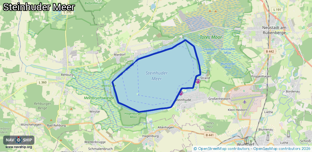
Lake
Driving areas:
🇩🇪 Germany
Length:
19.2 km¹
¹River kilometers or bank length recorded in NavShip, including river arms and harbor entrances.
Availability:
Completely recorded
Recent Update: 05.07.2023²
² This date indicates when an adjustment last took place in the course of the body of water
Recorded:
Locks: 0
Harbours / marinas: 2
Bridges: 0
Berths: 0
Slipways: 4
Fuelstations: 0
Route:
Please wait, loading route graphic...
Request waterway overview map with symbol legend here (Link).
Information about data associated with this body of water (6 available):
Data by OpenSeaMap (c) OSM contributors, www.openseamap.org
| # | Kind | Coordinates | Name | Information |
|---|---|---|---|---|
| 1 | Marina | 52.46115,9.35627 | 2016-06-28T08:41:03Z | |
| 2 | Marina | 52.46934,9.3756 | 2021-11-26T19:59:59Z | Baltische Segler-Vereinigung e.V. +49 5033 8845 http://www.baltische-segler-vereinigung.de/ |
| 3 | Slipway | 52.46033,9.35723 | small_craft_facility | 2016-06-28T08:41:03Z |
| 4 | Slipway | 52.46177,9.36573 | small_craft_facility | 2016-06-28T17:11:09Z |
| 5 | Slipway | 52.46268,9.36874 | small_craft_facility | 2016-06-13T12:22:06Z |
| 6 | Slipway | 52.489,9.31843 | small_craft_facility | 2018-08-03T14:17:56Z |