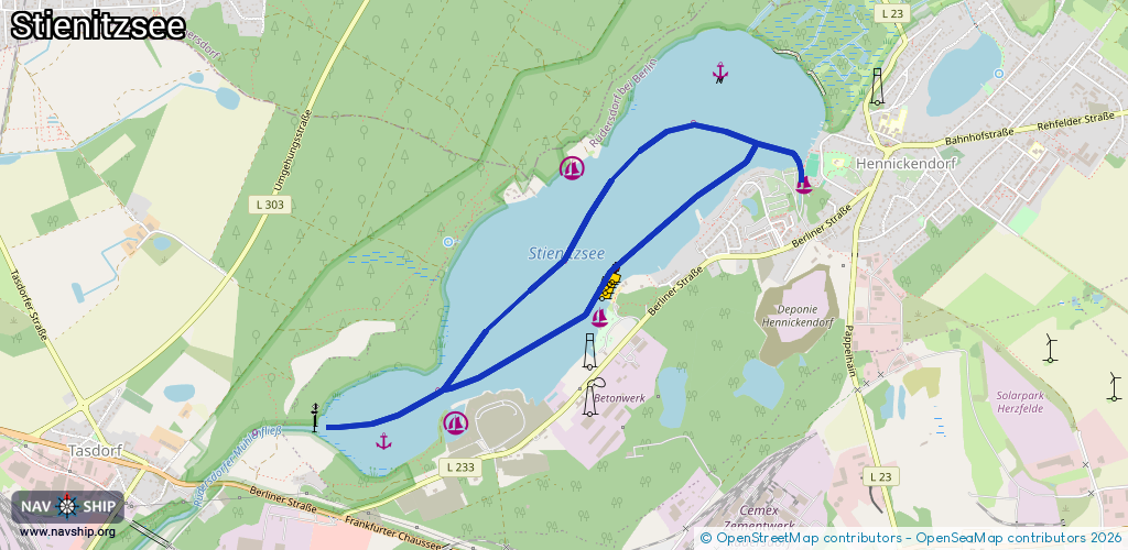
Waterway information

Kind:
Inland
Driving areas:
🇩🇪 Germany
Length:
5.5 km¹
¹River kilometers or bank length recorded in NavShip, including river arms and harbor entrances.
Availability:
Completely recorded
Recent Update: 09.07.2024²
² This date indicates when an adjustment last took place in the course of the body of water
Recorded:
Locks: 0
Harbours / marinas: 4
Bridges: 0
Berths: 2
Slipways: 1
Fuelstations: 0
Route:
Please wait, loading route graphic...
Request waterway overview map with symbol legend here (Link).
Information about data associated with this body of water (7 available):
Data by OpenSeaMap (c) OSM contributors, www.openseamap.org
| # | Kind | Coordinates | Name | Information |
|---|---|---|---|---|
| 1 | Marina | 52.50583,13.83976 | 2013-03-31T19:40:38Z | |
| 2 | Marina | 52.50649,13.82169 | 2014-05-19T21:04:36Z | MC Stienitzsee [email protected] +49 33434 14695 http://www.wodan-solutions.com/user/mcs/index.htm |
| 3 | Marina | 52.4995,13.82384 | 2013-04-02T08:48:11Z | MC Stienitzsee |
| 4 | Marina | 52.49439,13.81262 | 2023-11-02T08:44:23Z | Seglervereinigung Stienitzsee [email protected] +49 172 3221037 https://www.svstienitzsee.de/ |
| 5 | Slipway | 52.50638,13.83808 | small_craft_facility | 2013-03-31T19:40:42Z Slipanlage Hennickendorf |
| 6 | Berth | 52.51111,13.83325 | 2013-05-18T21:11:45Z | |
| 7 | Berth | 52.49351,13.80702 | 2013-05-18T21:12:38Z |