Waterway information

Kind:
Inland
Driving areas:
🇩🇪 Germany
Length:
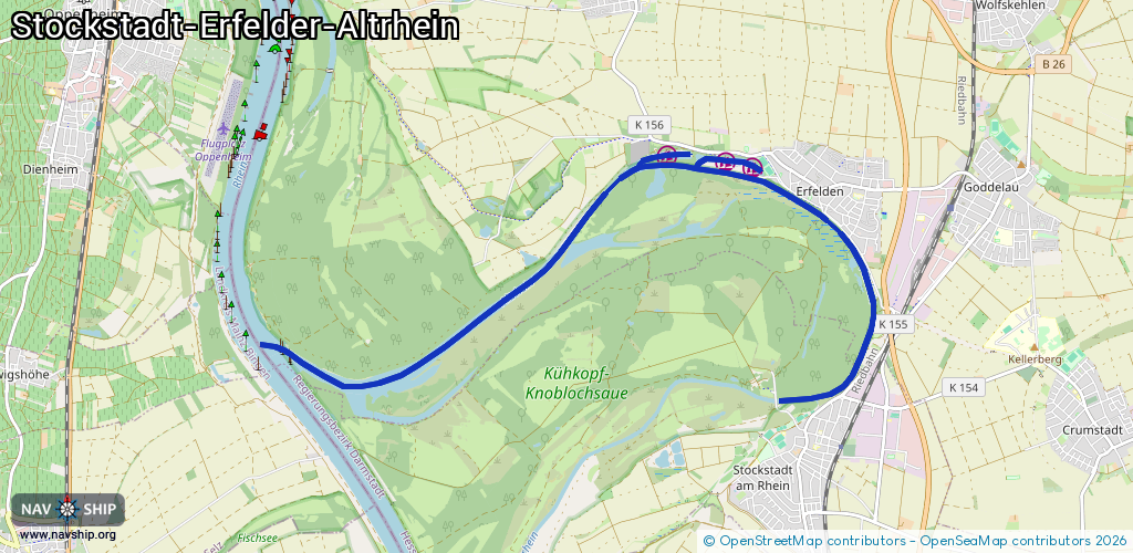
11.7 km¹
¹River kilometers or bank length recorded in NavShip, including river arms and harbor entrances.
Availability:
Completely recorded
Recent Update: 03.12.2025²
² This date indicates when an adjustment last took place in the course of the body of water
Recorded:
Locks: 0
Harbours / marinas: 3
Bridges: 0
Berths: 0
Slipways: 2
Fuelstations: 0
Route:
Please wait, loading route graphic...
Request waterway overview map with symbol legend here (Link).
Information about data associated with this body of water (5 available):
Data by OpenSeaMap (c) OSM contributors, www.openseamap.org
| # | Kind | Coordinates | Name | Information |
|---|---|---|---|---|
| 1 | Marina | 49.83848,8.44552 | 2023-11-07T14:12:14Z | Marina Georg Fretter [email protected] +49 6158 2993 https://www.fretter.web site/ |
| 2 | Marina | 49.8371,8.45885 | 2025-03-16T18:53:26Z | Yacht Club Erfelden [email protected] +49 151 11663268 http://www.ycerfelden.de/ |
| 3 | Marina | 49.8378,8.45451 | 2016-01-25T22:39:34Z | Sportboothafen Westhafen |
| 4 | Slipway | 49.83824,8.44134 | small_craft_facility | 2023-11-07T14:14:13Z Bootsrampe |
| 5 | Slipway | 49.81608,8.47371 | small_craft_facility | 2017-06-19T11:05:34Z |