Waterway information

Kind:
Inland
Driving areas:
🇩🇪 Germany🌊 North Sea
Length:
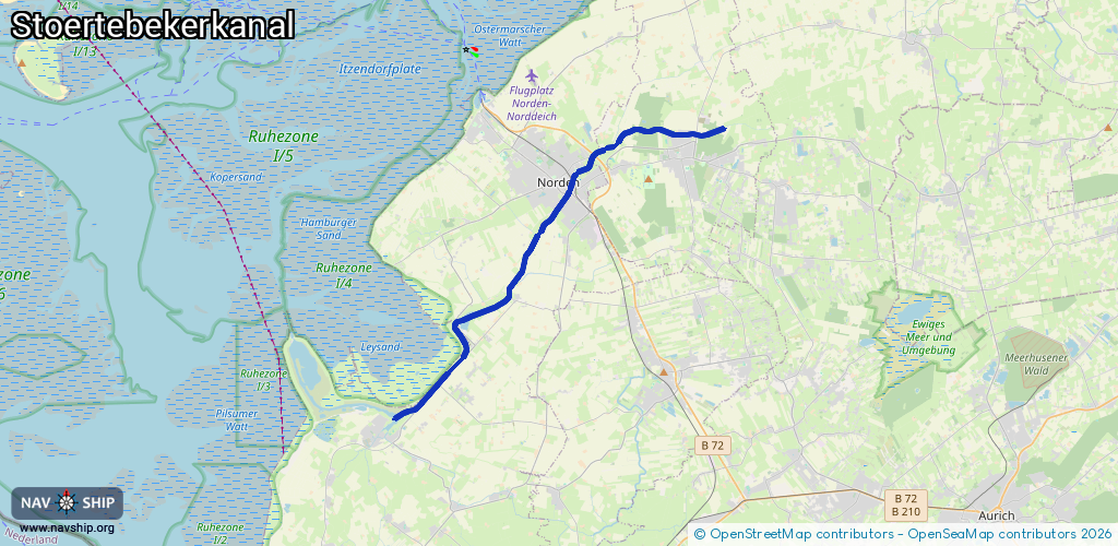
21.1 km¹
¹River kilometers or bank length recorded in NavShip, including river arms and harbor entrances.
Availability:
Completely recorded
Recent Update: 21.10.2022²
² This date indicates when an adjustment last took place in the course of the body of water
Recorded:
Locks: 0
Harbours / marinas: 2
Bridges: 1
Berths: 0
Slipways: 0
Fuelstations: 0
Route:
Please wait, loading route graphic...
Request waterway overview map with symbol legend here (Link).
Information about data associated with this body of water (3 available):
Data by OpenSeaMap (c) OSM contributors, www.openseamap.org
| # | Kind | Coordinates | Name | Information |
|---|---|---|---|---|
| 1 | Marina | 53.58985,7.2115 | 2020-07-14T11:23:28Z | Yachthafen Norden |
| 2 | Marina | 53.50666,7.10857 | 2018-08-10T01:23:21Z | Leybucht [email protected] http://www.leybucht-sportboot.de |
| 3 | Bridge | 53.50893,7.11234 | Unknown | Clearance height: 2025-11-17T09:43:40Z m Movable bridge (e.g. lifting bridge or drawbridge) opening |