Waterway information

Kind:
Inland
Driving areas:
🇩🇰 Denmark
Length:
2 km¹
¹River kilometers or bank length recorded in NavShip, including river arms and harbor entrances.
Availability:
Completely recorded
Recent Update: 17.11.2025²
² This date indicates when an adjustment last took place in the course of the body of water
Recorded:
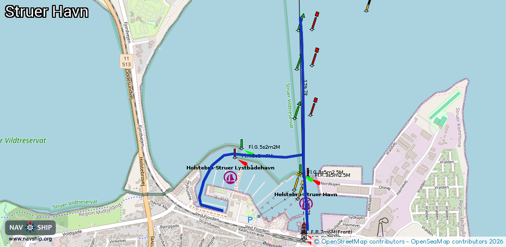
Locks: 0
Harbours / marinas: 2
Bridges: 0
Berths: 0
Slipways: 0
Fuelstations: 0
Route:
Please wait, loading route graphic...
Request waterway overview map with symbol legend here (Link).
Information about data associated with this body of water (2 available):
Data by OpenSeaMap (c) OSM contributors, www.openseamap.org
| # | Kind | Coordinates | Name | Information |
|---|---|---|---|---|
| 1 | Marina | 56.49513,8.59072 | 2024-01-14T09:29:05Z | Holstebro-Struer Havn |
| 2 | Marina | 56.49387,8.59729 | 2024-01-14T09:56:31Z | Holstebro-Struer Havn [email protected] +45 97850228 http://www.struerhavn.dk/ |