Waterway information

Kind:
Inland
Driving areas:
🇺🇸 United States of America
Length:
27.8 km¹
¹River kilometers or bank length recorded in NavShip, including river arms and harbor entrances.
Availability:
Completely recorded
Recent Update: 16.02.2024²
² This date indicates when an adjustment last took place in the course of the body of water
Recorded:
Locks: 0
Harbours / marinas: 10
Bridges: 0
Berths: 0
Slipways: 3
Fuelstations: 0
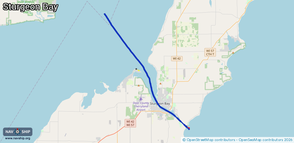
Route:
Please wait, loading route graphic...
Request waterway overview map with symbol legend here (Link).
Information about data associated with this body of water (13 available):
Data by OpenSeaMap (c) OSM contributors, www.openseamap.org
| # | Kind | Coordinates | Name | Information |
|---|---|---|---|---|
| 1 | Marina | 44.82311,-87.37273 | 2025-07-13T21:53:33Z | Quarterdeck Marina |
| 2 | Marina | 44.82464,-87.37509 | 2025-07-13T21:53:33Z | |
| 3 | Marina | 44.82437,-87.37435 | 2025-07-13T21:53:33Z | |
| 4 | Marina | 44.82548,-87.37672 | 2025-07-13T21:53:33Z | |
| 5 | Marina | 44.82957,-87.37507 | 2025-07-13T21:53:33Z | |
| 6 | Marina | 44.83154,-87.37812 | 2025-07-14T20:00:52Z | |
| 7 | Marina | 44.83211,-87.38333 | 2023-10-28T22:33:54Z | Harbor Club Marina +1-888-334-6739 https://www.skipperbuds.com/Page.aspx/locationId/2583/pageId/9310/view/Detail/Harbor-Club-Marina-WI.aspx |
| 8 | Marina | 44.8327,-87.37918 | 2025-07-14T20:00:52Z | |
| 9 | Marina | 44.83332,-87.37993 | 2022-07-02T17:30:39Z | |
| 10 | Marina | 44.83499,-87.38156 | 2025-07-13T21:53:33Z | |
| 11 | Slipway | 44.82257,-87.37208 | Unknown | 2016-04-14T09:24:15Z |
| 12 | Slipway | 44.82462,-87.37747 | Unknown | 2017-01-17T19:42:14Z |
| 13 | Slipway | 44.82465,-87.37579 | Unknown | 2017-01-17T19:42:13Z |