Waterway information

Kind:
Inland
Driving areas:
🇭🇺 Hungary
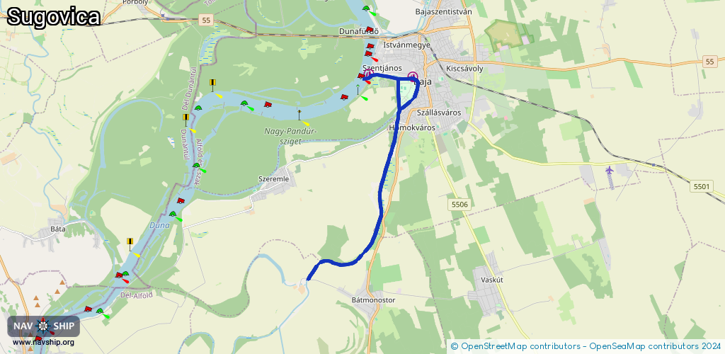
Length:
12.9 km¹
¹River kilometers or bank length recorded in NavShip, including river arms and harbor entrances.
Availability:
Completely recorded
Recent Update: 13.08.2023²
² This date indicates when an adjustment last took place in the course of the body of water
Recorded:
Locks: 1
Harbours / marinas: 2
Bridges: 0
Berths: 0
Slipways: 0
Fuelstations: 0
Route:
Please wait, loading route graphic...
Request waterway overview map with symbol legend here (Link).
Information about data associated with this body of water (2 available):
Data by OpenSeaMap (c) OSM contributors, www.openseamap.org
| # | Kind | Coordinates | Name | Information |
|---|---|---|---|---|
| 1 | Marina | 46.17964,18.94705 | 2021-04-22T05:31:25Z | Hajoker Bootsclub Strom/Wasser, 24h-Bewachung, keine Sanitäranlagen, teuer |
| 2 | Marina | 46.18063,18.92573 | 2022-07-05T07:50:12Z | |
| 2 | Marina | 46.18063,18.92573 | 2022-07-05T07:50:12Z |