Waterway information

Kind:
Inland
Driving areas:
🌊 Pacific Ocean🇹🇼 Taiwan
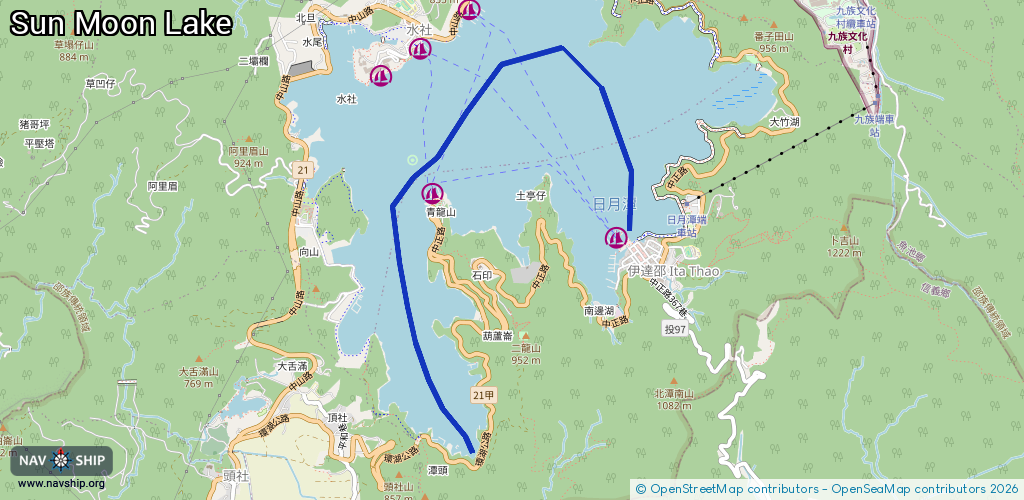
Length:
6.2 km¹
¹River kilometers or bank length recorded in NavShip, including river arms and harbor entrances.
Availability:
Completely recorded
Recent Update: 29.01.2025²
² This date indicates when an adjustment last took place in the course of the body of water
Recorded:
Locks: 0
Harbours / marinas: 5
Bridges: 0
Berths: 0
Slipways: 0
Fuelstations: 0
Route:
Please wait, loading route graphic...
Request waterway overview map with symbol legend here (Link).
Information about data associated with this body of water (5 available):
Data by OpenSeaMap (c) OSM contributors, www.openseamap.org
| # | Kind | Coordinates | Name | Information |
|---|---|---|---|---|
| 1 | Marina | 23.84956,120.92877 | 2022-01-03T07:04:45Z | 伊達紹碼頭 |
| 2 | Marina | 23.86749,120.91615 | 2023-04-19T12:47:56Z | 朝霧碼頭 |
| 3 | Marina | 23.86439,120.91195 | 2023-04-19T12:47:56Z | 水社碼頭 |
| 4 | Marina | 23.86228,120.90857 | 2024-05-12T06:17:24Z | 蔣公碼頭 |
| 5 | Marina | 23.85304,120.91299 | 2023-04-19T12:47:56Z | 玄光碼頭 |