Waterway information

Kind:
Inland
Driving areas:
🇺🇸 United States of America
Length:
12.6 km¹
¹River kilometers or bank length recorded in NavShip, including river arms and harbor entrances.
Availability:
Completely recorded
Recent Update: 03.06.2025²
² This date indicates when an adjustment last took place in the course of the body of water
Recorded:
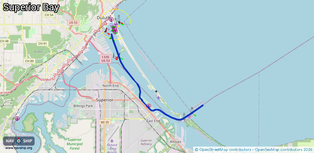
Locks: 0
Harbours / marinas: 1
Bridges: 0
Berths: 3
Slipways: 1
Fuelstations: 0
Route:
Please wait, loading route graphic...
Request waterway overview map with symbol legend here (Link).
Information about data associated with this body of water (5 available):
Data by OpenSeaMap (c) OSM contributors, www.openseamap.org
| # | Kind | Coordinates | Name | Information |
|---|---|---|---|---|
| 1 | Marina | 46.71611,-92.05445 | 2025-05-11T23:09:02Z | Barkers Island Marina https://barkers-island-marina.com/ |
| 2 | Slipway | 46.71434,-92.05305 | Unknown | 2025-05-11T23:09:02Z |
| 3 | Berth | 46.7665,-92.09052 | 2026-01-17T02:51:44Z | Duluth Harbor Basin Anchorage Buoy B anchorage |
| 4 | Berth | 46.75899,-92.09703 | 2026-01-18T00:56:58Z | Duluth Marine Terminal |
| 5 | Berth | 46.76295,-92.08813 | 2026-01-17T02:51:44Z | Duluth Harbor Basin Anchorage Buoy C anchorage |