Waterway information

Kind:
Inland
Driving areas:
🌊 Baltic Sea🇵🇱 Poland
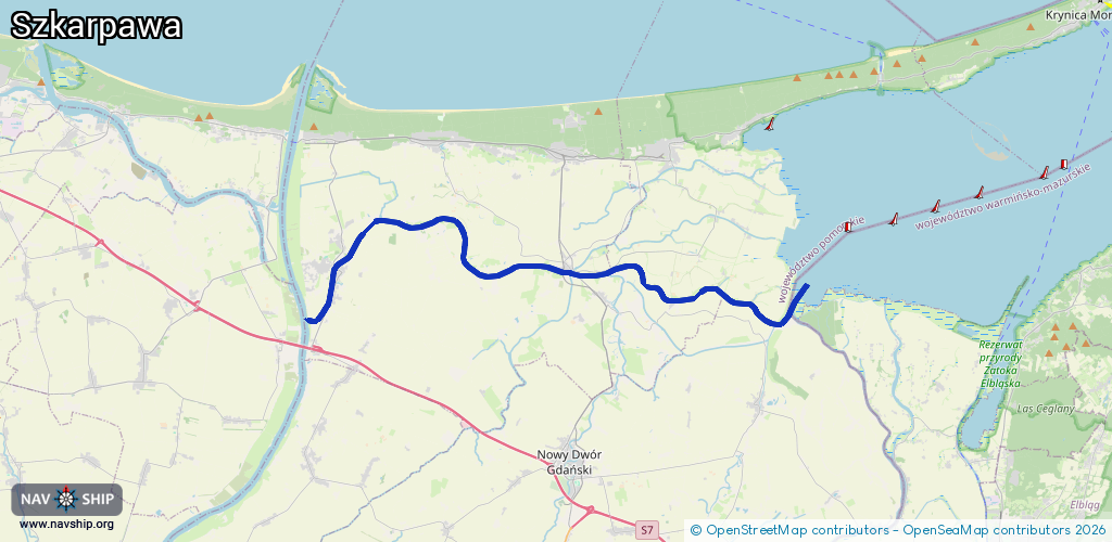
Length:
27.6 km¹
¹River kilometers or bank length recorded in NavShip, including river arms and harbor entrances.
Availability:
Completely recorded
Recent Update: 08.04.2025²
² This date indicates when an adjustment last took place in the course of the body of water
Recorded:
Locks: 1
Harbours / marinas: 4
Bridges: 3
Berths: 0
Slipways: 0
Fuelstations: 0
Route:
Please wait, loading route graphic...
Request waterway overview map with symbol legend here (Link).
Information about data associated with this body of water (8 available):
Data by OpenSeaMap (c) OSM contributors, www.openseamap.org
| # | Kind | Coordinates | Name | Information |
|---|---|---|---|---|
| 1 | Marina | 54.26531,19.24402 | 2017-03-03T14:53:25Z | Mała przystań wędkarska |
| 2 | Marina | 54.2729,19.2246 | 2024-02-05T10:28:22Z | Przystań Żeglarska im. Melchiora Wańkowicza [email protected] https://marinagold.pl/ |
| 3 | Marina | 54.2866,19.11931 | 2025-09-26T03:56:07Z | Przystań Na Żuławach - Rybina [email protected] https://przystannazulawach.pl/ |
| 4 | Marina | 54.28519,19.11341 | 2024-08-12T10:18:10Z | Przystań żeglarska w Rybinie https://petlazulawska.pl/mariny/przystan-w-rybinie/ |
| 5 | Bridge | 54.28424,19.11815 | 11.7 | Clearance height: 2023-12-21T23:13:50Z m Maximum passage width: 1.6 m bascule |
| 6 | Bridge | 54.28574,19.11767 | 6.4 | Clearance height: 2023-12-21T23:13:50Z m Maximum passage width: 2.2 m bascule |
| 7 | Bridge | 54.28696,18.96709 | 12.5 | Clearance height: 2023-12-22T12:08:13Z m Maximum passage width: 3 m bascule |
| 8 | Lock | 54.26677,18.9523 | Unknown |