Waterway information

Kind:
Inland
Driving areas:
🇮🇹 Italy🌊 Sea Mediterranean
Length:
33.6 km¹
¹River kilometers or bank length recorded in NavShip, including river arms and harbor entrances.
Availability:
Completely recorded
Recent Update: 05.04.2025²
² This date indicates when an adjustment last took place in the course of the body of water
Recorded:
Locks: 1
Harbours / marinas: 4
Bridges: 0
Berths: 0
Slipways: 0
Fuelstations: 1
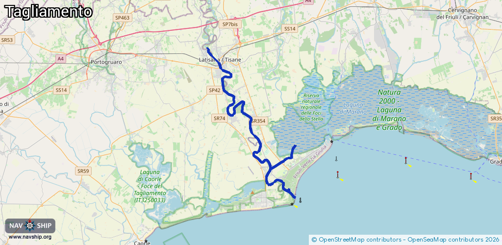
Route:
Please wait, loading route graphic...
Request waterway overview map with symbol legend here (Link).
Information about data associated with this body of water (6 available):
Data by OpenSeaMap (c) OSM contributors, www.openseamap.org
| # | Kind | Coordinates | Name | Information |
|---|---|---|---|---|
| 1 | Marina | 45.65016,13.09363 | 2024-09-23T21:37:31Z | |
| 2 | Marina | 45.67175,13.066 | 2025-04-29T20:18:07Z | Adriamare |
| 3 | Marina | 45.65688,13.0659 | 2024-09-14T18:28:20Z | Marina Punta Verde |
| 4 | Marina | 45.65722,13.0663 | 2022-05-23T15:23:23Z | Marina Punta Verde |
| 5 | Fuel station | 45.64982,13.09292 | 2025-07-12T19:20:01Z | Noaloil |
| 6 | Lock | 45.6716,13.06895 | Unknown |