Waterway information

Kind:
Inland
Driving areas:
🇩🇪 Germany
Length:
1.1 km¹
¹River kilometers or bank length recorded in NavShip, including river arms and harbor entrances.
Availability:
Completely recorded
Recent Update: 09.01.2023²
² This date indicates when an adjustment last took place in the course of the body of water
Recorded:
Locks: 0
Harbours / marinas: 2
Bridges: 0
Berths: 0
Slipways: 0
Fuelstations: 0
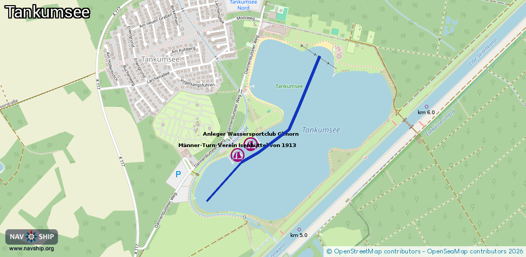
Route:
Please wait, loading route graphic...
Request waterway overview map with symbol legend here (Link).
Information about data associated with this body of water (2 available):
Data by OpenSeaMap (c) OSM contributors, www.openseamap.org
| # | Kind | Coordinates | Name | Information |
|---|---|---|---|---|
| 1 | Marina | 52.45057,10.61777 | 2015-09-02T23:51:18Z | Anleger Wassersportclub Gifhorn [email protected] +49 5374 3231 http://www.wscg.de/ |
| 2 | Marina | 52.45002,10.61668 | 2023-11-03T23:02:50Z | Männer-Turn-Verein Isenbüttel von 1913 [email protected] +49 5374 91843233 https://www.mtvi-segeln.de/ |