Waterway information

Kind:
Inland
Driving areas:
🌊 North Sea🇬🇧 United Kingdom
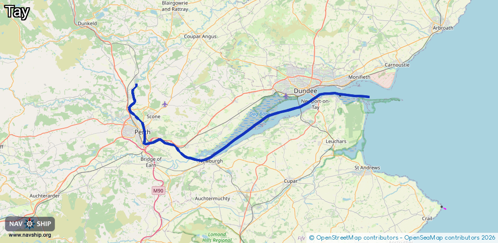
Length:
56.1 km¹
¹River kilometers or bank length recorded in NavShip, including river arms and harbor entrances.
Availability:
Completely recorded
Recent Update: 21.08.2023²
² This date indicates when an adjustment last took place in the course of the body of water
Recorded:
Locks: 0
Harbours / marinas: 1
Bridges: 0
Berths: 1
Slipways: 1
Fuelstations: 0
Route:
Please wait, loading route graphic...
Request waterway overview map with symbol legend here (Link).
Information about data associated with this body of water (3 available):
Data by OpenSeaMap (c) OSM contributors, www.openseamap.org
| # | Kind | Coordinates | Name | Information |
|---|---|---|---|---|
| 1 | Marina | 56.45137,-2.88034 | 2023-02-15T17:51:16Z | Tayport Harbour |
| 2 | Slipway | 56.46474,-2.87745 | small_craft_facility | 2021-01-03T10:14:43Z |
| 3 | Berth | 56.46654,-2.89152 | 2017-01-18T11:32:38Z | small_craft |