Waterway information

Kind:
Inland
Driving areas:
🇳🇱 Netherlands
Length:
22.3 km¹
¹River kilometers or bank length recorded in NavShip, including river arms and harbor entrances.
Availability:
Completely recorded
Recent Update: 30.01.2026²
² This date indicates when an adjustment last took place in the course of the body of water
Recorded:
Locks: 1
Harbours / marinas: 1
Bridges: 6
Berths: 1
Slipways: 1
Fuelstations: 0
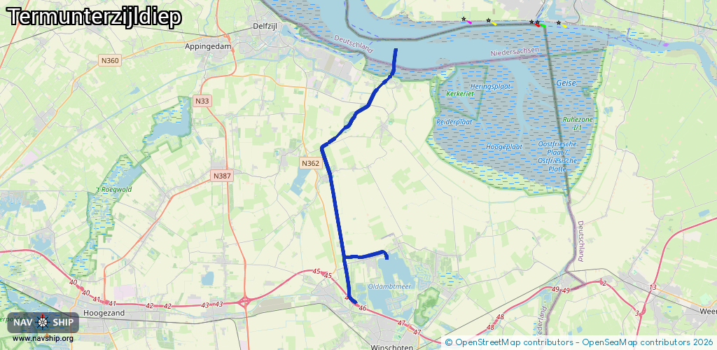
Route:
Please wait, loading route graphic...
Request waterway overview map with symbol legend here (Link).
Information about data associated with this body of water (10 available):
Data by OpenSeaMap (c) OSM contributors, www.openseamap.org
| # | Kind | Coordinates | Name | Information |
|---|---|---|---|---|
| 1 | Marina | 53.30211,7.03489 | 2024-06-23T19:26:28Z | WSV de Eems https://www.wsvdeeems.nl/ |
| 2 | Bridge | 53.26031,6.96863 | 6.1 | Clearance height: 2013-04-04T15:20:46Z m Maximum passage width: 1 m Movable bridge (e.g. lifting bridge or drawbridge) opening |
| 3 | Bridge | 53.28209,7.00449 | Unknown | Clearance height: 2013-04-04T15:20:46Z m Movable bridge (e.g. lifting bridge or drawbridge) fixed |
| 4 | Bridge | 53.28598,7.01474 | 10 | Clearance height: 2013-04-04T15:20:46Z m Maximum passage width: 2.65 m Movable bridge (e.g. lifting bridge or drawbridge) fixed |
| 5 | Bridge | 53.29521,7.02338 | 6 | Clearance height: 2013-04-04T15:09:52Z m Maximum passage width: 1.2 m Movable bridge (e.g. lifting bridge or drawbridge) opening |
| 6 | Bridge | 53.30051,7.0355 | 7.5 | Clearance height: 2013-04-04T15:09:52Z m Maximum passage width: 1.6 m Movable bridge (e.g. lifting bridge or drawbridge) opening |
| 7 | Bridge | 53.30164,7.03677 | 7.95 | Clearance height: 2022-06-05T13:14:33Z m Maximum passage width: 10.4 m Movable bridge (e.g. lifting bridge or drawbridge) opening |
| 8 | Slipway | 53.19627,7.03203 | small_craft_facility | 2024-11-14T14:35:34Z |
| 9 | Berth | 53.31788,7.0362 | 2026-02-10T15:57:27Z | D/O-Reede anchorage |
| 10 | Lock | 53.30134,7.03369 | Unknown |