Waterway information

Kind:
Inland
Driving areas:
🇳🇱 Netherlands
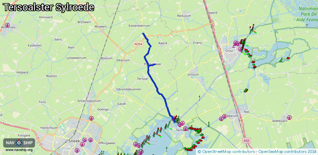
Length:
8.4 km¹
¹River kilometers or bank length recorded in NavShip, including river arms and harbor entrances.
Availability:
Completely recorded
Recent Update: 24.07.2023²
² This date indicates when an adjustment last took place in the course of the body of water
Recorded:
Locks: 2
Harbours / marinas: 2
Bridges: 5
Berths: 0
Slipways: 0
Fuelstations: 0
Route:
Please wait, loading route graphic...
Request waterway overview map with symbol legend here (Link).
Information about data associated with this body of water (7 available):
Data by OpenSeaMap (c) OSM contributors, www.openseamap.org
| # | Kind | Coordinates | Name | Information |
|---|---|---|---|---|
| 1 | Marina | 53.04857,5.77116 | 2023-05-30T18:16:23Z | Jachthaven Sneekerhof [email protected] +31 566 689 595 https://www.sneekerhof.nl |
| 2 | Marina | 53.0477,5.77176 | 2016-11-25T00:24:10Z | Jachthaven Sneekerhof |
| 3 | Bridge | 53.08395,5.74691 | Unknown | Clearance height: 2022-01-04T14:55:25Z m |
| 4 | Bridge | 53.10212,5.74005 | Unknown | Clearance height: 2025-10-14T17:06:45Z m fixed |
| 5 | Bridge | 53.0848,5.74225 | Unknown | Clearance height: 2022-01-04T14:55:24Z m |
| 6 | Bridge | 53.07742,5.7438 | Unknown | Clearance height: 2022-01-04T14:55:25Z m |
| 7 | Bridge | 53.06726,5.75239 | Unknown | Clearance height: 2022-01-04T14:55:25Z m |
| 7 | Bridge | 53.06726,5.75239 | Unknown | Clearance height: 2022-01-04T14:55:25Z m |
| 7 | Bridge | 53.06726,5.75239 | Unknown | Clearance height: 2022-01-04T14:55:25Z m |