Waterway information

Kind:
Inland
Driving areas:
🇩🇪 Germany
Length:
5.6 km¹
¹River kilometers or bank length recorded in NavShip, including river arms and harbor entrances.
Availability:
Completely recorded
Recent Update: 05.07.2024²
² This date indicates when an adjustment last took place in the course of the body of water
Recorded:
Locks: 0
Harbours / marinas: 2
Bridges: 1
Berths: 0
Slipways: 0
Fuelstations: 0
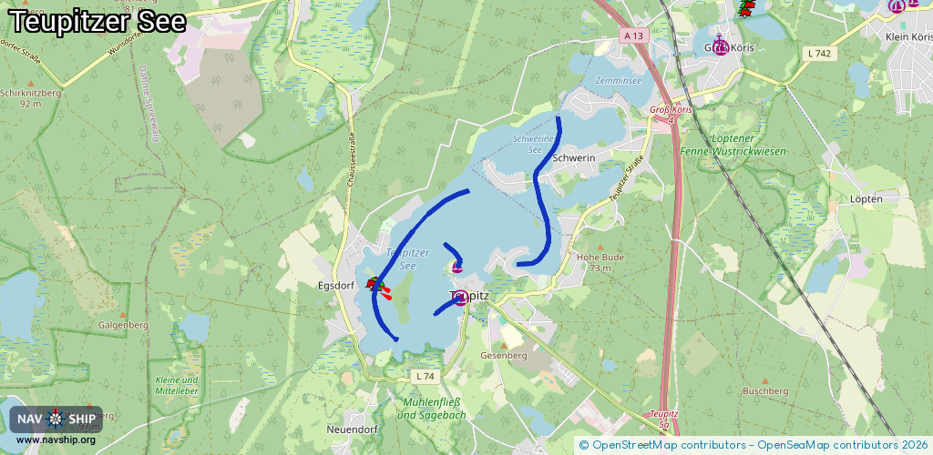
Route:
Please wait, loading route graphic...
Request waterway overview map with symbol legend here (Link).
Information about data associated with this body of water (3 available):
Data by OpenSeaMap (c) OSM contributors, www.openseamap.org
| # | Kind | Coordinates | Name | Information |
|---|---|---|---|---|
| 1 | Marina | 52.1356,13.60821 | 2015-09-10T15:23:57Z | Hafen Teupitz +49 33766 62496 |
| 2 | Marina | 52.13943,13.60757 | 2014-04-17T15:29:57Z | Schlosshotel Teupitz |
| 3 | Bridge | 52.14928,13.62222 | Unknown | Clearance height: 2019-07-22T17:13:51Z m Maximum passage width: 1.2 m Movable bridge (e.g. lifting bridge or drawbridge) fixed nur Kanu, flach und niedrig, Durchgangshöhe 1,90 m über Grund, 0,3 m max. Tiefgang, Durchfahrt für Motorboote verboten. |