Waterway information

Kind:
Inland
Driving areas:
🇮🇹 Italy🌊 Sea Mediterranean
Length:
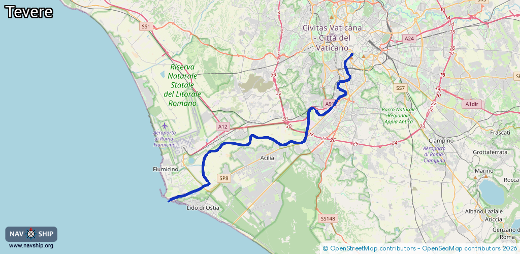
37 km¹
¹River kilometers or bank length recorded in NavShip, including river arms and harbor entrances.
Availability:
Completely recorded
Recent Update: 25.08.2023²
² This date indicates when an adjustment last took place in the course of the body of water
Recorded:
Locks: 0
Harbours / marinas: 2
Bridges: 0
Berths: 0
Slipways: 2
Fuelstations: 0
Route:
Please wait, loading route graphic...
Request waterway overview map with symbol legend here (Link).
Information about data associated with this body of water (4 available):
Data by OpenSeaMap (c) OSM contributors, www.openseamap.org
| # | Kind | Coordinates | Name | Information |
|---|---|---|---|---|
| 1 | Marina | 41.74567,12.25189 | 2016-10-25T13:38:05Z | Porto di Fiumicino |
| 2 | Marina | 41.74192,12.24198 | 2021-01-19T16:46:05Z | Cantieri di Ostia Small Harbour |
| 3 | Slipway | 41.74978,12.26623 | small_craft_facility | 2013-05-12T15:20:34Z cable winch |
| 4 | Slipway | 41.747,12.25542 | small_craft_facility | 2013-05-12T15:20:34Z cable winch |