Waterway information

Kind:
Inland
Driving areas:
🌊 Atlantic Ocean🇺🇸 United States of America
Length:
28 km¹
¹River kilometers or bank length recorded in NavShip, including river arms and harbor entrances.
Availability:
Completely recorded
Recent Update: 11.02.2026²
² This date indicates when an adjustment last took place in the course of the body of water
Recorded:
Locks: 0
Harbours / marinas: 12
Bridges: 0
Berths: 0
Slipways: 1
Fuelstations: 0
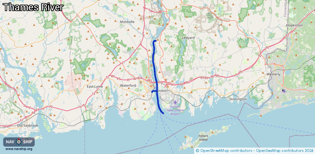
Route:
Please wait, loading route graphic...
Request waterway overview map with symbol legend here (Link).
Information about data associated with this body of water (13 available):
Data by OpenSeaMap (c) OSM contributors, www.openseamap.org
| # | Kind | Coordinates | Name | Information |
|---|---|---|---|---|
| 1 | Marina | 41.34803,-72.10018 | 2022-04-11T09:44:55Z | Crocker's Boatyard |
| 2 | Marina | 41.52516,-72.08269 | 2026-02-07T16:28:32Z | Thayer's Marine |
| 3 | Marina | 41.33059,-72.09329 | 2025-08-08T13:50:16Z | Thames Yacht Club |
| 4 | Marina | 41.38514,-72.09869 | 2022-06-04T17:19:33Z | Boating on the Thames http://www.boatingonthames.com/ |
| 5 | Marina | 41.38882,-72.08873 | 2023-08-10T19:16:04Z | The Sub Base |
| 6 | Marina | 41.40584,-72.09382 | 2023-08-10T19:16:04Z | Small Boat Marina |
| 7 | Marina | 41.43381,-72.08963 | 2026-01-26T10:55:19Z | Gales Ferry Marina |
| 8 | Marina | 41.33485,-72.09684 | 2025-08-08T13:50:16Z | Burr's Marina |
| 9 | Marina | 41.33668,-72.09948 | 2025-08-07T21:46:35Z | A.W. Marina |
| 10 | Marina | 41.33834,-72.09967 | 2022-10-02T22:09:07Z | Ferry Slip Dockominiums |
| 11 | Marina | 41.33816,-72.0989 | 2025-08-07T21:46:35Z | Ferry Slip |
| 12 | Marina | 41.34209,-72.09495 | 2022-04-10T12:50:22Z | Fort Trumbull Marina https://www.ctvisit.com/listings/fort-trumbull-marina |
| 13 | Slipway | 41.34619,-72.09334 | small_craft_facility | 2022-04-09T15:55:07Z U.S. Coast Guard - Station New London |