Waterway information

Kind:
Inland
Driving areas:
🌊 Atlantic Ocean🇬🇧 United Kingdom
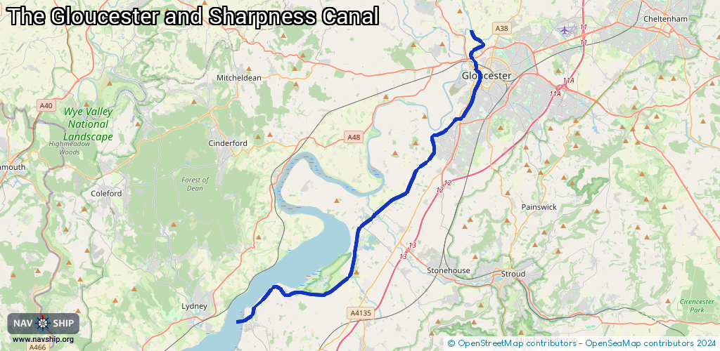
Length:
31 km¹
¹River kilometers or bank length recorded in NavShip, including river arms and harbor entrances.
Availability:
Completely recorded
Recent Update: 21.08.2023²
² This date indicates when an adjustment last took place in the course of the body of water
Recorded:
Locks: 2
Harbours / marinas: 0
Bridges: 0
Berths: 0
Slipways: 0
Fuelstations: 1
Route:
Please wait, loading route graphic...
Request waterway overview map with symbol legend here (Link).
Information about data associated with this body of water (1 available):
Data by OpenSeaMap (c) OSM contributors, www.openseamap.org
| # | Kind | Coordinates | Name | Information |
|---|---|---|---|---|
| 1 | Fuel station | 51.77553,-2.36549 | 2023-05-25T19:59:54Z | Frampton on Severn Industrial Park Mo-Fr 08:30-16:00 |
| 1 | Fuel station | 51.77553,-2.36549 | 2023-05-25T19:59:54Z | Frampton on Severn Industrial Park Mo-Fr 08:30-16:00 |
| 1 | Fuel station | 51.77553,-2.36549 | 2023-05-25T19:59:54Z | Frampton on Severn Industrial Park Mo-Fr 08:30-16:00 |