Waterway information

Kind:
Lake
Driving areas:
🇨🇭 Switzerland
Length:
47.1 km¹
¹River kilometers or bank length recorded in NavShip, including river arms and harbor entrances.
Availability:
Completely recorded
Recent Update: 22.02.2026²
² This date indicates when an adjustment last took place in the course of the body of water
Recorded:
Locks: 0
Harbours / marinas: 9
Bridges: 0
Berths: 0
Slipways: 7
Fuelstations: 0
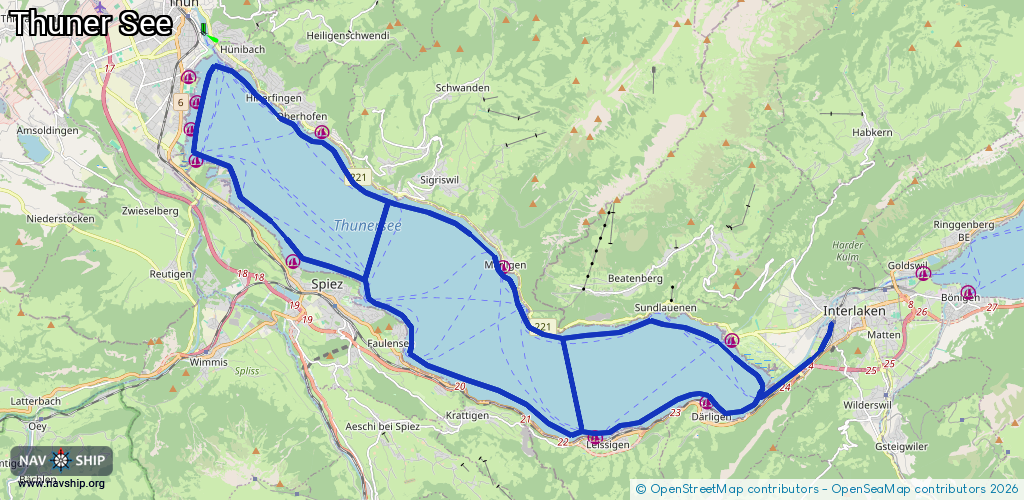
Route:
Please wait, loading route graphic...
Request waterway overview map with symbol legend here (Link).
Information about data associated with this body of water (16 available):
Data by OpenSeaMap (c) OSM contributors, www.openseamap.org
| # | Kind | Coordinates | Name | Information |
|---|---|---|---|---|
| 1 | Marina | 46.73462,7.63274 | 2021-08-17T20:24:22Z | |
| 2 | Marina | 46.72819,7.63068 | 2021-08-17T20:24:22Z | |
| 3 | Marina | 46.72083,7.63244 | 2021-08-17T20:24:22Z | |
| 4 | Marina | 46.69704,7.66574 | 2021-08-17T20:24:22Z | Weidli |
| 5 | Marina | 46.65568,7.76952 | 2021-09-13T09:07:52Z | Leissigen |
| 6 | Marina | 46.66396,7.80779 | 2025-07-27T18:29:05Z | Därligen |
| 7 | Marina | 46.67844,7.81633 | 2022-12-23T14:37:58Z | SC Neuhaus |
| 8 | Marina | 46.69565,7.73771 | 2024-11-10T22:12:20Z | |
| 9 | Marina | 46.72754,7.67568 | 2021-09-05T18:10:43Z | Oberhofen |
| 10 | Slipway | 46.73473,7.6304 | small_craft_facility | 2025-09-18T22:39:36Z |
| 11 | Slipway | 46.73427,7.63055 | small_craft_facility | 2025-09-16T22:21:54Z |
| 12 | Slipway | 46.73403,7.63076 | small_craft_facility | 2025-09-16T22:21:54Z |
| 13 | Slipway | 46.728,7.62933 | small_craft_facility | 2025-09-16T22:21:54Z |
| 14 | Slipway | 46.71837,7.62976 | small_craft_facility | 2021-08-17T20:24:22Z |
| 15 | Slipway | 46.71308,7.64411 | small_craft_facility | 2021-08-17T20:24:22Z |
| 16 | Slipway | 46.67863,7.81669 | small_craft_facility | 2022-09-10T17:08:02Z |